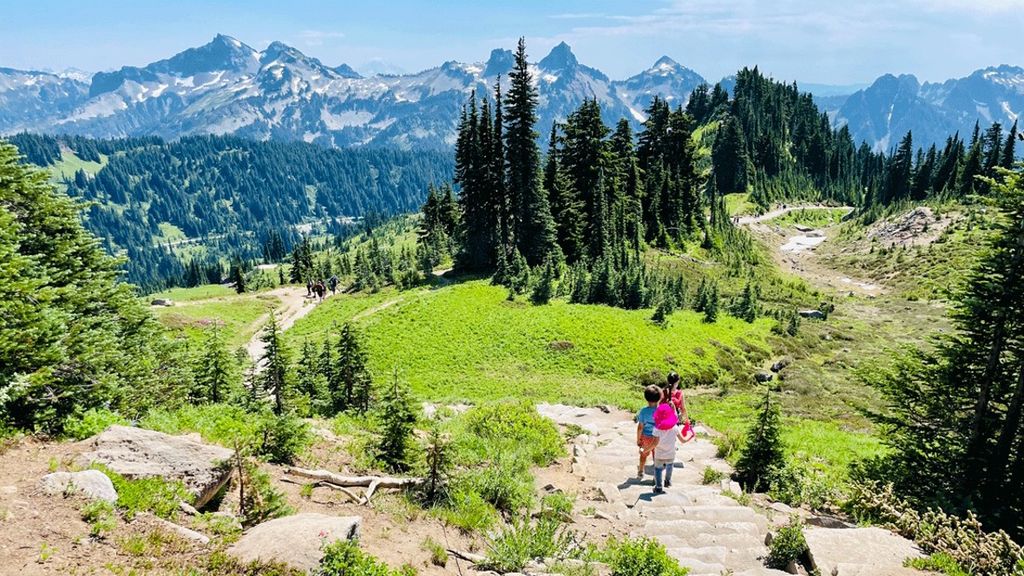
The Cascade Range is home to hundreds of breathtaking waterfalls, from towering, roaring falls that engage all five senses to gentle mountain streams that invite peaceful relaxation. These cascades are fueled by winter rains and melting snow, making spring a spectacular time to witness their beauty.
But before you set off on a waterfall adventure, safety comes first — especially when spring runoff is at its peak. Rushing water can be more powerful than it looks, and loose rocks often tumble down with the current. Always admire large waterfalls from a safe distance, and never attempt to climb them or wade directly into their flow. If little explorers want to dip their toes in a shallow stream or backcountry pool, make sure they’re closely supervised and wearing sturdy, slip-resistant shoes.
Finally, before heading out, check trail and road conditions to ensure a smooth adventure. Washington Trails Association’s trip reports are a great resource for up-to-date information. With the right precautions, you and your family can safely enjoy the magic of these stunning natural wonders.
With those safety tips in mind, let’s get going!
Snoqualmie Falls, Snoqualmie Pass

Kids will love: Viewing this absolutely massive and powerful waterfall from both above (at the upper observation deck) and below (at the lower observation deck).
Highlights: The top of Snoqualmie Falls is only 100 yards from the parking lot — head here to the upper and lower observation decks first. On nice weekends and summer days, you might be jostling elbows to get a perfect view of this mist-throwing marvel, Washington’s most popular waterfall and a top tourist destination. Many of those tourists are avid fans of the ’90s cult-classic TV show “Twin Peaks,” which prominently featured the Snoqualmie River, the falls and adjacent Salish Lodge. Watch in awe at the enormous volume of the falls as the Snoqualmie River plunges a sheer 268 feet into a massive amphitheater of rock.
For the hike to the base of the falls, take the wide interpretive trail (a mix of gravel, boardwalk and wooden steps) down 0.7 miles to the base of the lower falls. Take time to read signs along the way that explain the natural history of the area, hydroelectric projects, and how the falls are sacred to the Snoqualmie Tribe. There is a parking lot at the base of the falls if you don’t wish to hike down for this view, but space is limited.
Distance: 1.4 miles round-trip, 280 feet elevation gain
Info: The falls are owned by the Snoqualmie Indian Tribe, along with the Salish Lodge and Spa. Check current trail conditions and trip reports on the WTA website.
Directions: Drive I-90 east to Exit 25, then head north on Snoqualmie Parkway for 3.6 miles. Turn left onto Railroad Avenue and look for visitor parking. Free parking is available in the upper lot across the pedestrian sky bridge, while some closer/lower parking is paid.
Cherry Creek Falls, Duvall

Kids will love: Discovering a crashed car in the middle of the forest along the trail. Once you reach the falls, kids can watch the water plunge into a pool where swimmers sometimes cool off in the summer. Tossing rocks into the water and feeling the refreshing mist from the falls will make the adventure even more fun!
Highlights: This is a gorgeous, fairly flat hike through a moss-covered forest along burbling streams. At 2.5 miles in and 2.5 miles back, it’s a long hike. Depending on the ages in your group, be prepared with snacks and plan for breaks along the way. It is known to be a muddy trail and you must cross a few streams, so waterproof shoes or boots are a must. (The last stream before reaching the falls can be dangerous to cross in the springtime. Check conditions on the WTA website or avoid this trail in the spring season.) Once you ford the creek, you will hear the roar of Cherry Creek Falls. Find your way through a small patch of forest and you’ll come to a stunning clearing featuring the impressive 25-foot falls. The trail is well marked and easy to follow. The falls flow year-round but the left-hand side generally dries up by autumn.
Distance: 5 miles round-trip, 450 feet elevation gain
Info: The first half mile of this trail is a courtesy easement within private property in the central Cascades. It is important to remain on the trails. Check current conditions and trip reports on the WTA website.
Directions: From the junction of state Route 203 and Woodinville-Duvall Road in downtown Duvall, head north on SR 203 for about 500 feet, then turn right on Northeast Cherry Valley Road. Follow this road for 4.3 miles to Mountain View Road, turn left and park on the west shoulder of Mountain View Road. There is no public parking lot. Parking is limited to the shoulder of Mountain View Road only. There is no trail access near road signs marked Private or No Parking. During the spring season, you must cross a large stream right before reaching the falls.
Sol Duc Falls, Olympic National Park

Kids will love: Spotting the falls and catching the mist from several different angles via the footbridge and rustic viewing platforms constructed by the National Park Service.
Highlights: Set in the heart of Olympic National Park’s temperate rain forest and enveloped by a mossy, fern-laden canyon, the swollen Sol Duc River splits into two, three or even four segments as it spills with thunder beneath your feet. This stunning 37-foot plunge into a narrow gorge is uniquely viewable from above on a high wooden footbridge and from other rustic platforms, giving you different angles onto its enthralling torrent. And it’s not finished — after the initial plunge, the river spills again in an 11-foot drop down a narrow gorge.
Getting to the falls is easy hiking on a short, well-maintained trail, so don’t hesitate to bring your good camera and a tripod; photographers fancy Sol Duc Falls to be one of the most beautiful waterfalls to shoot in the region.
Distance: 1.6 miles round-trip, 200 feet elevation gain
Info: The Olympic National Park Visitor Center can be reached by phone at (360) 565-3130. Check current conditions and trip reports on the WTA website.
Directions: From Port Angeles, take U.S. 101 west for 31 miles and turn left onto Sol Duc-Hot Springs Rd. The trailhead is at the road’s end, about 14 miles in; check Olympic National Park road conditions before you go. A National Park Pass is required.
Whatcom Falls, Bellingham

Kids will love: The sight of gorgeous cascading falls fit for a national park but in an urban setting.
Highlights: Whatcom Falls Park spans 241 acres of shady forest, a tumbling creek and a lagoon that provides habitat for dabbling ducks, plus more than 5 miles of trails that pass four cascading waterfalls (Upper Whatcom Falls, Whatcom Falls, Whirlpool Falls and Pixie Falls).
Walk a short paved trail from the parking lot to the historic stone bridge that spans Whatcom Creek. Hear the roar and feel the spray of the crashing waterfall on your left — this is Whatcom Falls, just 100 yards from the parking lot and shrouded in a mossy green forest. The falls will be at their fullest during the spring snowmelt or after a big rain. Look down — the sandstone bridge under your feet hails from the Great Depression, a project of the Works Progress Administration.
For more falling water, continue just beyond the bridge to a trail intersection. First, head right (north) to get a view above the main falls. Large sandstone boulders make for a great vantage point, but keep kids close and don’t wade into the creek here. As you continue on the trail, you’ll pass a small, 2-foot unnamed fall along the way, but keep walking. At 0.2 miles, when the creek is full, you’ll get a nice view of the 13-foot segmented plunge falls known as Upper Whatcom Falls.
Backtrack the way you came to the intersection by the stone bridge, and continue the other way (south) as the trail follows the lovely gorge downstream, staying within earshot of the turbulent creek. At 0.3 miles you’ll get to the stout but sweet Whirlpool Falls, a plunging punchbowl falls that drops into a locally loved swimming hole on hot days. Turn around to return to the parking lot, or keep exploring the trails of this park for a longer hike.
Distance: About 1.5 miles for this shorter waterfall route; WTA lists a 4-mile round-trip park hike with 50 feet of elevation gain.
Info: Check current conditions and trip reports at the WTA website.
Directions: Whatcom Falls Park is 86 miles north of Seattle. Drive I-5 north up to Bellingham (Exit 253). Head east on Lakeway Drive for 1.5 miles, then make a left at Silver Beach Road, the entrance to Whatcom Falls Park. The main parking lot and trailhead are about half a mile into the park.
Twin Falls, North Bend

Kids will love: Mossy old-growth forest seldom found so close to home, and an exciting footbridge to cross to see the falls.
Highlights: Twin Falls is one of the most popular family hikes in our region for great reason — the falls are beautiful year-round, fed by North Bend’s ample rainfall. Kids will love the trail leading to the falls from the get-go, as moss-draped trees flank the south fork of the Snoqualmie River over a ground filled with nurse logs and spring wildflowers (keep an eye out for early blooms of trillium). At about three-quarters of a mile in you’ll find the first viewpoint of the falls; let kids stop to rest on one of the benches and consider this a turn-around spot for younger children. One more mile of the trail brings you to the trail’s big payoff, a high footbridge over the river right between the two waterfalls.
Distance: 3 miles round-trip, 500 feet elevation gain
Info: The Twin Falls hike is within Olallie State Park. Check current conditions and trip reports on the WTA website.
Directions: Drive I-90 east to exit 34 and turn right (south) on 468th Avenue Southeast. After half a mile, turn left onto Southeast 159th and continue another half-mile to the trailhead. A Discover Pass is required to park.
Wallace Falls, North Cascades

Kids will love: Interesting steps, turnpikes and switchbacks, many of them built by high school students.
Highlights: One of the most stunning waterfalls in Washington state, Wallace Falls is the star attraction of this state park, also home to a family-friendly campground with rentable cabins. Wallace Falls comprises an upper, middle and lower falls, largest plunging a dramatic 265 vertical feet into a large amphitheater, then churning and tumbling two more times, sending a cool spray in every direction.
From the parking lot, the path to the falls starts under power lines, complete with electrical popping sounds that may or may not be fascinating to your little ones. On a clear day, the view of Baring Mountain and Mount Index makes up for the hissing wires overhead. You’ll finish this stretch soon enough, though, and come to a junction in the woods. Take a right on the Woody Trail through a fern-shrouded hemlock forest about two miles to the lower falls, the last portion consisting mostly of stairs and switchbacks. Traverse more switchbacks to get a better look at the middle falls viewpoint, this hike’s turnaround spot.
Distance: 5.6 miles round-trip, 1300 feet elevation gain
Info: Check current conditions and trip reports at the WTA website.
Directions: From Everett, take U.S. 2 east for 28 miles into the small town of Gold Bar. Turn left onto First Street, the signed turnoff for Wallace Falls State Park (it is just before milepost 28). At a four-way stop, turn right onto May Creek Road and drive 1.5 miles to Wallace Falls State Park. A Discover Pass is required to park. Also note: Parking is limited. As per the WTA website, please do not park along Ley Road, which accesses the parking area for Wallace Falls State Park.
Boulder River, North Cascades

Kids will love: Log bridges crossing small streams, wading in the chilly river, climbing rocks and staying cool on a hot day!
Highlights: If towering, moss-draped trees and pounding waterfalls are your thing, you’ll love the Boulder River Trail which has plenty of both. Winding through one of the few remaining low-elevation, old-growth forests in the Cascades, the lush, 8.6-mile out-and-back hike passes sword ferns, cedars and several cliffside waterfalls that plunge into the trail’s namesake river. From the start, your ears are filled with the sound of flowing, gurgling water, and this trail hugs the beautiful Boulder River most of the way to the trail’s eventual dead end.
The first waterfall, Boulder Falls, is not visible from the main trail. A mile in you’ll enter Boulder Creek Wilderness. At 1.25 miles you’ll discover the trail’s highlight, Feature Show Falls, a massive twin curtain waterfall that streams down a moss-laden cliff wall. Take a seat on the provided bench and gawk. Just beyond, hike (carefully) down to the river for a perfect lunch spot. Kids will love wading in the river here (on a hot day) and climbing the rocks. For a short hike, turn around here. Otherwise continue through the mossy, verdant wonderland to the trail’s end, have a break on the riverbank, and then come back the way you came.
Distance: Up to 8.6 miles round-trip, 1000 feet elevation gain
Info: Check current conditions and trip reports on the WTA website.
Directions: From I-5 take Exit 208 onto Highway 530 and head east toward Arlington. Stay on 530 through Arlington. At 23.6 miles from I-5, turn right onto French Creek Road, just after milepost 41. Follow French Creek Road to its end at the trailhead. No parking pass is required. Hikers have noted the road to the trailhead has many potholes; drive carefully!
Murhut Falls, Olympic National Forest

Kids will love: Blooming wild rhododendrons tucked among the ferns.
Highlights: Short and sweet, the trail to Murhut Falls delivers its reward — an enchanting 130-foot tiered waterfall — in just under a mile of easy walking, often with fewer crowds than better-known waterfall hikes. Although the hike is not well known, it is well maintained, and the ascent is gentle enough for small children as the trail is a converted logging road.
Use caution and hold small hands in the final ascent to the falls as the trail gets narrow and there’s a drop-off to one side. This fern-fringed forest is pretty any time of year, but late spring offers a special enticement — blooming pink Pacific rhododendrons.
Distance: 1.6 miles round-trip, 250 feet elevation gain
Info: Check current conditions and trip reports on the WTA website.
Directions: From Quilcene, drive south on U.S. 101 to milepost 310, and turn right (west) onto the Duckabush Road. Drive 6.3 miles to a fork, and veer right another 1.3 miles to the trailhead. No parking pass is required; the trailhead has a small parking area and no potable water.
Marymere Falls, Olympic Peninsula

Kids will love: Steps and bridges fashioned from old-growth logs.
Highlights: The Marymere Falls Nature Trail is well trodden by families in search of the 90-foot cascading falls that drop from a notch in a high, sheer cliff. Set off from the parking lot of the Storm King Ranger Station on a paved portion of the trail that passes under U.S. 101, then forks off to the left beside a gentle stream through mossy old-growth woods. Be sure to look up — these trees are giants!
You’ll soon come to another trail junction; take a right and cross Barnes Creek on a sturdy bridge built by volunteers with the Washington Trails Association. From here it’s a quick 200-foot climb to the narrow, fern-laden ravine. Falls Creek plunges out of the cliff into a moss-ringed pool near the trail. Take the stairs to the right of the falls for a fantastic view near the upper portion.
Distance: 2 miles round-trip, 500 feet elevation gain
Info: Check current conditions and trip reports at the WTA website.
Directions: Take U.S. 101 west from Port Angeles 20 miles to milepost 228, turning right onto a road signed “Lake Crescent Lodge and Marymere Falls.” Drive 0.2 miles to a stop sign, turn right and park. A National Park Pass or Olympic National Park entrance fee is required.
Bridal Veil Falls, North Cascades

Kids will love: Feeling the spray and hearing the roar of the plunging falls
Highlights: The popular hike to this draping cataract waterfall kind of resembles a tiered bridal veil, hence its name. Pack rain jackets even if the sky is blue — you’ll need them below the falls where the air is thick with a refreshing, misty spray. It’s like a natural water park.
The trail to Bridal Veil Falls is also the trail to Lake Serene, the body of water from which the lovely falls are fed. For nearly 2 miles the path is a gentle old logging road bed flanked by a mossy mixed forest of conifers, maple and alder. You’ll cross a few gentle streams on rock steps, so the family should wear waterproof boots (we bring along extra socks, too). Once the path rises from the road bed, a fork in the trail emerges. Hikers bound for the lake go left, but you’ll go right. Over the next half-mile to the falls, you’ll climb up fairly steep switchbacks and cedar stair steps to reach the base of the falls and the first viewing platform. More stair steps take you to the higher viewing platform and a refreshing shower. Once you’ve soaked up the scenery, turn around and return the way you came. Note: Keep kids close when venturing near the falls and remind them of safety rules.
Distance: 4.4 miles round-trip, 850 feet elevation gain
Info: The trail is in Mount Baker-Snoqualmie National Forest, Snohomish County. Check current conditions and trip reports on the WTA website.
Directions: From Everett, take U.S. 2 east for 28 miles to the small town of Gold Bar, then continue 7 miles more. Just before the highway crosses over the Skykomish River, take a right onto Mount Index Road. After 0.4 miles on this road, take a right onto a side road signed “Lake Serene Trail.” The parking area is just ahead, and a Northwest Forest Pass is required to park.
Carter Falls, Mount Rainier National Park

Kids will love: The cool footbridge that spans a milky, glacially fed river.
Highlights: Most of this trail is wide and flat through a pristine old-growth forest. Marvel at the girth of the ancient Douglas fir and cedar trees here. Hold onto kids’ hands when crossing the cool footbridge over the Nisqually River, and remind them to look up while midspan on the bridge for a spectacular view of “The Mountain.”
There are two beautiful waterfalls on this kid-friendly hike, Carter Falls and Madcap Falls, the latter just a short distance beyond the former and worth the extra steps.
Begin on the famous Wonderland Trail heading east from Longmire. In the summer months you may encounter backpackers hiking the entire 93-mile trek that circumnavigates Mount Rainier, a journey that takes about 10 days. This family-friendly stretch of Wonderland Trail starts flat and wide, first alongside the Paradise Road then pulling away into the quiet wilderness along the Nisqually River. At about 2 miles, you’ll come back to the road and the Cougar Rock Campground when the trail turns sharply east to cross the wide floodplain of the Nisqually River. After crossing the Nisqually River on the log bridge, the trail hugs the Paradise River for about a mile through the emerald moss-cloaked forest to Carter Falls. After you’ve had your fill at the viewpoint, walk on beyond these falls another 150 feet to see Madcap Falls.
For a shorter version, start from the Carter Falls Trailhead near Cougar Rock Campground; WTA lists this route as 2.8 miles round-trip with 660 feet of elevation gain.
Distance: 7 miles round-trip, 900 feet elevation gain
Info: Check conditions at this Mount Rainier webcam or on WTA website as the Nisqually River log footbridge can wash out, and the route is not safe/passable when the bridge is out.
Directions: Longmire at Mount Rainier is about two hours from Seattle. Take I-5 south to Tacoma, then drive east on state Route 7 to Elbe. From there, continue on state Route 706 through Ashford to the Nisqually Entrance to the park, where you must pay the entrance fee to Mount Rainier National Park (or show your fourth grader’s Every Kid Outdoors pass). After entering the park, continue on Paradise Road heading east 6.5 miles to the Longmire Museum and the National Park Inn. Park in the large parking lot behind the inn. The trailhead is on the north end of the lot, signed for the Wonderland Trail. Head east on the Wonderland Trail. Timed-entry reservations are not required in 2026, but visitors should still expect summer congestion and check the park website before going.
Myrtle Falls, Mount Rainier National Park

Kids will love: Whistling marmots, wildflowers of every color in the crayon box, clear views of real glaciers.
Highlights: If you do this hike in summer, when it’s at its best, chubby, frolicking marmots and elaborate fields of wildflowers will captivate your attention for the short jaunt to this postcard-perfect waterfall, fed by water from melting snow off the volcano’s slopes and the Nisqually Glacier. Relatively flat and on stroller-friendly pavement, it’s one of only a handful of barrier-free trails to waterfalls in the Pacific Northwest.
The path to Myrtle Falls begins on the northeast edge of Paradise Inn, and is actually the first stretch of the uber-popular Skyline Trail. By summer, the open meadows flanking the trail are bursting with beauties such as avalanche lilies, lupine, valerian, magenta paintbrush and pasqueflower. Amble along the half-mile to the falls, taking in the scenery and pausing for close looks at the many wildflowers. On a clear day, the mountain’s glaciers look so close you feel you might be able to reach out and touch them. Soon the trail crosses a sturdy footbridge directly above the silky cascade of Myrtle Falls. Stay on the trail bridge to look directly down onto the falls, or find the spur trail nearby that takes you down for a closer look.
Pavement ends just past the waterfall, so if you don’t have a stroller and want more of a hike just continue on the Skyline Trail (5.5 miles round-trip, 1,700 feet elevation gain) as it climbs to a high overlook of Paradise Valley and provides great views of the volcanoes to the south (Mount St. Helens, Mount Adams and Mount Hood), plus a bonus tumbling cascade — Sluiskin Falls.
The trail to Myrtle Falls is usually accessible by July, like all of the flower trails departing from the Paradise area. Monitor conditions on this webcam or Mount Rainier National Park’s website.
Distance: 1 mile round-trip, 100 feet elevation gain
Info: More details are available on the Mount Rainier National Park and WTA websites. This hike is stroller-friendly and ADA-accessible. Not hikeable until summer, typically, and is at its peak in mid- to late summer.
Directions: The Paradise area and its surrounding trailheads are about 2.5 hours from Seattle. Take I-5 south to Tacoma, then drive east on state Route 7 to Elbe. From there, continue on state Route 706 through Ashford to the Nisqually Entrance to the park, where you must pay the entrance fee (or show your fourth grader’s Every Kid Outdoors pass). After entering the park, continue on Paradise Road heading east all the way to the Henry M. Jackson Memorial Visitor Center and Paradise Inn. The trailhead is located on the north side of the upper parking lot. Timed-entry reservations are not required in 2026, but visitors should expect congestion at Paradise in summer and check the park website before going.
Franklin Falls, Snoqualmie Pass

Kids will love: Actual ruts of pioneer-era wagon wheels on this history hike.
Highlights: From the trailhead, the short, easy trail to Franklin Falls runs alongside the old wagon track that led early settlers over the Cascades to lower Puget Sound. The falls are a mile in, but the whole path is scenic as it hugs the south fork of the Snoqualmie River. There is a drop-off on one side of the trail as you near the falls, occasionally fenced but sometimes not. Hold tight to little ones!
Your hike in finishes with a short, rocky ascent up to the base of the impressive falls, which spill from the top of a sheer rock face and send a fine mist into the air. Watch safely from the edge of the waterfall’s pool without venturing in; loose rocks sometimes tumble down with the water.
The Forest Service keeps the Franklin Falls Trail well maintained, but on the soggiest of days you may be dodging puddles, so wear waterproof shoes. The rocky path near the falls may be icy in winter and not suitable for small kids.
Distance: 2 miles round-trip, 400 feet elevation gain
Info: Franklin Falls Trailhead is in Mount Baker-Snoqualmie National Forest. In winter, Denny Creek Road/FS Road 58 may be closed to vehicles, adding significant mileage; check WTA and Forest Service conditions before going.
Directions: Take I-90 east to Exit 47. Turn left (north), cross the overpass and then make a right when the road comes to a “T.” After a quarter-mile, turn left on Denny Creek Road (FS58). Follow this road 2.5 miles to just past Denny Creek Campground and turn left onto a paved road. Parking is on the left and the trailhead is on the right. Roadside parking is not permitted. A Northwest Forest Pass is required to park; in winter, check whether a Sno-Park Permit is required for alternate parking.
Editor’s note: This article was originally published several years ago and updated most recently on May 26, 2026, by ParentMap’s editorial team. Kari Hanson and Devon Hammer contributed to this article.