Stroller-friendly hikes for Northwest families
Editor’s note: Just about everything changes when you add a baby to the mix. But outdoors-loving Northwest families with babies and young children don’t have to give up forays into the mountains. In this excerpt from the 2018 guidebook “Best Hikes With Kids: Western Washington,” published by Mountaineers Books, author Susan Elderkin picks out five hikes that are most conducive to strollers and little legs. So, head for the hills with your tots in tow to enjoy the gorgeous views, breathe in the mountain air and connect with nature.
Text and photos excerpted with permission from “Best Hikes With Kids: Western Washington,” (Mountaineers Books, April 2018) by Susan Elderkin.
First trail: West Hylebos Wetlands
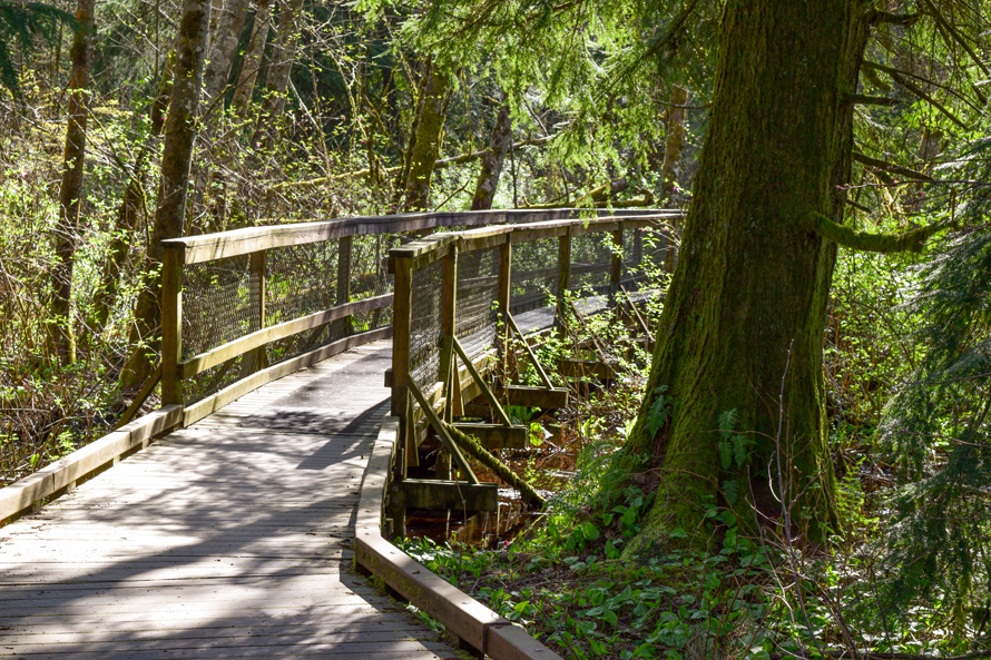
West Hylebos Wetlands
Overview: The West Hylebos Wetlands trail in Federal Way is a 1.4-mile loop with 25 feet of elevation gain, and a year-round hiking option. This gem tucked away in the heart of Federal Way showcases wildlife, boardwalks and two historic cabins.
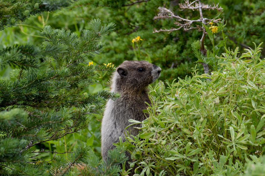
The West Hylebos Wetlands is one of those surprising places — a thriving oasis of green tucked away in a busy suburban area. Here, birds sing and frogs croak. Moss, lichen and ferns attach to nearly every surface. Water oozes from the ground, flows& and pools. Very old trees, plus two historic cabins, give visitors a sense that they are entering a world of yesteryear. And a level boardwalk sweeps through it all, making it an ideal destination for feet and strollers (sorry, bikes and dogs are not allowed).
This is one of the last, and largest, remaining peat bogs in South King County. The spongy soil is 30 feet deep in places and supports a diverse array of plants and animals — from tiny fungi and shy garter snakes to a Sitka spruce more than four hundred years old. Begin your walk at the two historic cabins adjacent to the parking lot. These buildings date to the 1880s, but they didn’t originate here. The distinctive Denny Cabin once housed a real estate office on Queen Anne Hill in Seattle, and the Barker Cabin sat a few miles away from this spot. Take time to peer inside and read the signs.
The Details: A wide crushed gravel pathway curves gently downhill, past a picnic area, about 0.2 mile to the beginning of the boardwalk. Shortly thereafter, reach a junction. The trail runs in a loop, and the interpretive signs tell a more logical story if you take it clockwise. Make sure to stop and read the first sign on the loop, which depicts the different kinds of wetlands you’ll encounter — the younger scrub shrub and the older forested wetlands — then look for the transitions during your walk.
The trail visits a few interesting nooks and crannies. The first is called the “deep sink,” a hole that used to be 20 feet deep, but is now filling in with mud and vegetation. Follow the boardwalk above the squishy wetlands, and at 0.5 mile reach an ancient Sitka spruce that’s 175 tall, but leaning rather precariously. A curious, large, carved wooden mushroom sits to the side of the trail.
At 0.7 mile, take the short detour to Brook Lake. It’s just 500 feet, and worth the effort to walk over the swampiest part of the trail and to gaze at the lovely reflections on the lake. Take a seat on a bench and soak up the peacefulness of this place. Return to the junction, going straight, and then meander 0.2 mile back to where you first began your circuit. Turn left, and return up the gravel pathway to the parking area. Make sure to return in a different season to see how the wetlands change.
Next trail: Gold Creek Pond
Gold Creek Pond
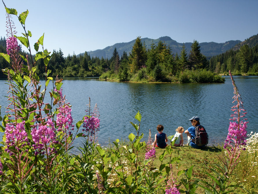
Overview: Gold Creek Pond, at Snoqualmie Pass, is a 1.4-mile loop with 25 feet of elevation gain, and a May-to-October hiking option. This level stroll atop Snoqualmie Pass is one of my favorite toddler hikes. There’s water, flowers, mountain views and a level, barrier-free stroll around the pond.
Even the smallest tykes feel confident striding on a level paved pathway and wooden boardwalks. Older children and adults will appreciate the pretty mountain views reflected in a tranquil pond. This is an excellent choice for one of those foggy Puget Sound summer days; you could shiver in the June gloom, but why not drive up Snoqualmie Pass and bask beyond the clouds in some summer sun?
The Details: Take the paved path to the left of the privy, soon coming to the loop trail. Head to the right, allowing the pond to slowly reveal itself. Travel alongside a babbling creek, through willows, flowers and a young forest. You may notice that some terrain looks sculpted. In the 1970s and ’80s, this quiet place was a gravel pit, serving the construction of Interstate 90. Huge cranes hoisted gravel into dump trucks until there was no more. In 1983, Washington Department of Transportation, in conjunction with the US Forest Service, began transforming this site into fish and wildlife habitat. I’ve been coming here for a decade, and each year the foliage looks wilder and more natural.
At 0.5 mile, reach a junction. The trail to the right takes hikers on a moderate ascent up the Gold Creek watershed. Continue left for the pond, just now coming into view, with clouds, trees, and mountains reflected brightly on its teal-colored surface. Below the boardwalk is a lush, marshy environment filled with ocean spray, bleeding hearts, yellow violets and ferns.
Because this trail is so short, we have always slowed down to savor it. I’ve let the kids throw rocks into the water below the bridge, inspect the shaggy moss in the creek that feeds the pond, and come up with names for the two small islands in the water. At 0.7 mile is a side trail. Take it! A little peninsula of green pushes far out into the pond, allowing kids the feeling of being in the center of a lake among jumping fish and skittering water bugs.
Having stretched out time as much as possible, press onward. At 1.1 mile, reach an expansive picnic area, complete with grills. The only thing it doesn’t have is shade. If you’re not spreading out a feast, cross over the creek again and head back to the trailhead.
Next trail: Nisqually Vista
Nisqually Vista
Overview: Nisqually Vista, near the Henry M. Jackson Visitor Center in Mount Rainier National Park, is a one-mile loop with 50 feet of elevation gain, and a July-to-mid-October hiking option. Recently repaved, this is the easiest hike at Mount Rainier’s Paradise, and suitable for wheelchairs, strollers and just walkers.
Mount Rainier’s Paradise is a study in verticality. Trails depart straight up the broad shoulders of the mountain, attaining dizzying heights quickly. The newly redone Nisqually Vista Trail is an exception. The entire mile-long loop is smooth pavement, suitable for wheelchairs, strollers, and the youngest of walkers who want to look at one of the mountain’s largest glaciers.
The Details: The trail begins at the far end of the lower parking lot, west of the visitor center. Look for the first photo opp almost immediately — a rock with a hole in the center and room for two. Just beyond, the trail takes off in a loop. Go right on a beeline for glacier vistas. At the half-mile mark there are four viewpoints for the Nisqually Glacier. The final one is the best. Check out the glacier’s gray toe and the white veins of water thundering through the barren valley. Round a corner and close the loop at 0.8 mile, returning right for the trailhead. To learn more about Mount Rainier’s glaciers, be sure to visit the upstairs portion of the nearby Henry M. Jackson Visitor Center.
Next trail: Rainy Lake
Rainy Lake
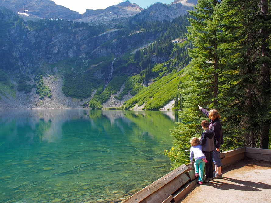
Overview: Rainy Lake, at Rainy Pass on Route 20 in the North Cascades, is a 1.8-mile roundtrip with 10 feet of elevation gain, and a June-to-October hiking option. A jewel-hued lake is a short jaunt down a barrier free path in the North Cascades. This is a great leg-stretcher when heading over the North Cascades Highway.
The trail is paved and level, with interpretive signs sprinkled throughout, and a jade-green lake twinkles in a rocky cirque at the end of the short trail. Its easily attained beauty is an exception to the rule that you must work hard to reap such a reward.
The Details: From the trailhead, head left on the paved trail, an ideal place for toddlers to try out their hiking feet. Because it is maintained by the Forest Service for wheelchair accessibility, there should be nothing on this path for them to trip over. The trail parallels the highway for 0.75 mile, and the occasional whir of vehicles is the price you pay for such a level hike. Interpretive signs identify trees like Engelmann spruce and Pacific silver fir. Our favorite sign describes a phenomenon called “pistol butt,” where the pressure of snow moving downhill bends the trunks of young trees.
At 0.4 mile, pass a side trail to Maple Pass, and at 0.75 mile curve away from road. Follow the sound of water for a few hundred more yards to a patio with two benches at Rainy Lake. The color and clarity of the lake is striking. You may even be able to spot fish. High, impassable cliffs surround the lake, and in June and July two distinct waterfalls pour loudly down the far side. If it is busy, a side trail leads beyond the patio to a couple of other vantages. When you are ready, retrace your steps to the parking area.
Next trail: Point Whitehorn
Point Whitehorn Marine Reserve
Overview: Point Whitehorn Marine Reserve in Bellingham is 1.6-mile roundtrip with 75 feet of elevation gain, and a year-round hiking destination. It’s smooth sailing on boardwalk and level trail all the way to a bluff, where toddlers will need a hand on the stairs to the beach.
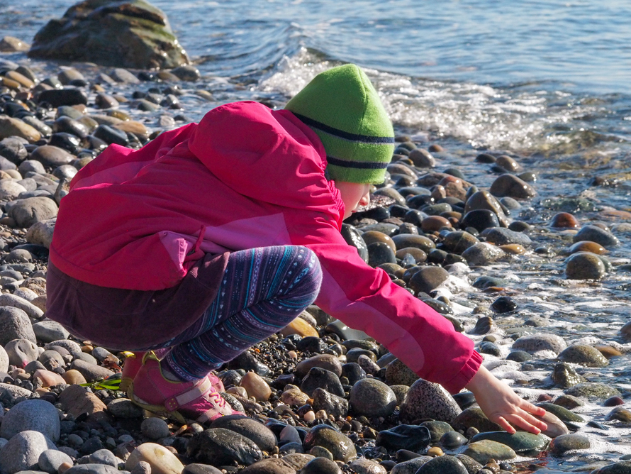
A wheelchair-accessible trail winds through wetlands and upland forest to a bluff with views out across the Strait of Georgia to a dozen San Juan Islands, including Orcas, Lummi, Cyprus and Sucia. Stairs to the cobblestone beach below offer opportunities to bask in its south-facing sun and dip bare feet into the chilly waters. The preservation of this sweet 54-acre tract is owed to a series of deft and creative land transactions by the Whatcom Land Trust in the early 2000s, which protects this habitat near the heavy industrial footprint of the Cherry Point Refinery.
The Details: Start your hike at the sign located in the middle of the parking area. Because it is a designated marine reserve, dogs are not allowed. The trail is wide enough to walk side by side and suitable for strollers. Interpretive signs add context for kids.
The forest includes a variety of native conifers like Douglas fir, Sitka spruce, western hemlock and western red cedar. It’s also boggy, but your way is dry thanks to a series of small bridges and boardwalks. Soon the conifers give way to deciduous forest of black cottonwood, big-leaf maple and more. Emerging from the forest, the trail travels along the bluff for a short distance, with three overlooks graced by lovely, polished stone benches at 0.75 mile.
This is where strollers must stop, but hikers can proceed 75 feet down the steep bluff and stairs to the beach. When the tide is low, you can explore and investigate tide pools (please step lightly and leave all marine life where you see it).
Next: More great hikes with kids
More great hikes with kids
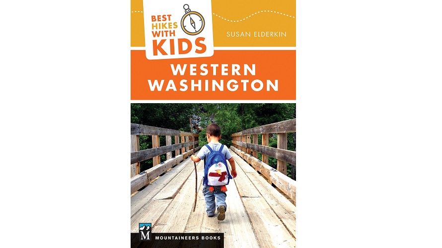
Editor’s note: Find more great hikes for your family in “Best Hikes With Kids: Western Washington,” featuring 125 hikes of no more than 6 miles in length, and all with fairly gentle elevation gain. Also included: where to find berries, see animals, or encounter some delightfully wild and weird places. So, gather your crew, stock up on snacks, and we’ll see you out on the trail! This excerpt was first published with permission in 2018 and updated with permission for 2023.