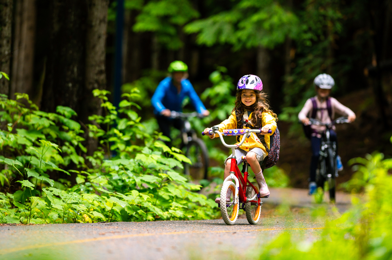

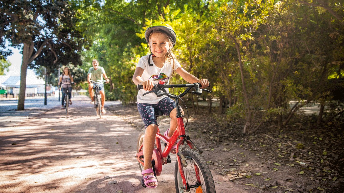
Need a great spot to let your kids practice riding a bike, zooming on a scooter or perfecting inline skating skills? Sometimes it’s hard to find a good trail that’s mostly flat and not too crowded. Even with kids who’ve mastered two (or more) wheels, a family bike ride on a car-free bike trail offers peace of mind — in addition to fun and exercise.
We’ve rounded up eight great trails around the South Sound — from Tacoma to Olympia — that are perfect for little legs. (If you’re looking for paths farther north, don’t miss our top picks for bike paths in Seattle and the Eastside.) Most have beautiful views, parks with play equipment and restrooms, too.
Now grab your helmets and get rolling!
Lake to Sound Connector Trail, Burien to Des Moines
A new section of the Lake to Sound Trail opened in summer 2025, offering families the opportunity to cycle from Burien to Des Moines on a paved path. It connects to the Des Moines Creek Trail, which will take you right to the rocky shoreline of Des Moines Beach, where you can relax and have a view of Maury Island.
The 12-foot-wide, non-motorized trail is part of a larger project. Once completed, the 16-mile Lake to Sound Trail will connect Renton, Tukwila, SeaTac, Burien and Des Moines, providing access to other regional trails and Link light rail stations. With the addition of this connector trail, the project is two-thirds complete.
Location: The connector trail extends from the intersection of Des Moines Memorial Drive and South Normandy Road in Burien to South 200th Street in Seatac, connecting to the Des Moines Creek Trail.
Trail details: This paved section of the Lake to Sound Trail is 2.2 miles long. Combined with the Des Moines Creek Trail, cyclists have 7 miles to ride.
Nearby: Stop at Angle Lake Park for a picnic with a view and a romp on the playground (bring your swimsuits in the summer to cool off in the lake or spray park!).
Milton Interurban Trail, Milton
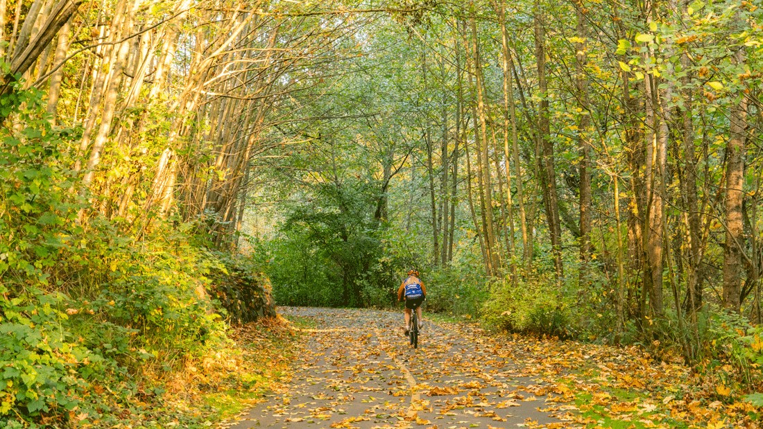
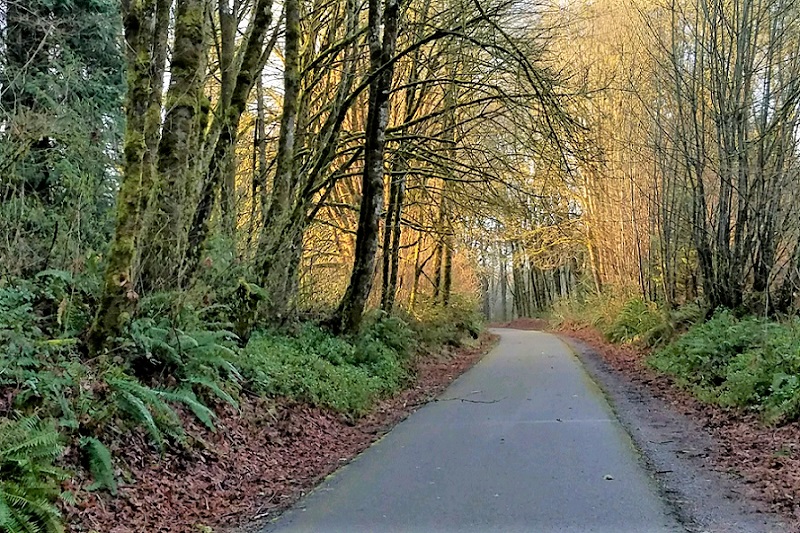
The Milton Interurban Trail is a scenic paved path following an old railroad right-of-way alongside Hylebos Creek, commonly called Sweetwater Creek, and meandering through the town of Milton. The best place to park is at the 70th Avenue East trailhead in Fife where there is a small parking lot. You’ll hear quite a bit of traffic noise at the beginning of the trail, but don’t worry. Once you get about a quarter-mile in and away from busy roads, it quiets down.
This trail is mostly flat and is really pretty with lots of evergreen and deciduous trees. This is not a loop, so just make a U-turn if you don’t want to go the entire way! Be sure to bring snacks and water bottles. Note that there are no bathrooms on the trail.
Location: Access the Milton Interurban Trail near the intersection of 70th Avenue East and 20th Street East in Fife.
Trail details: An out-and-back bike ride on the trail makes for a 5-mile round-trip.
Nearby: If the kids want to hit a park after their ride, check out Milton Community Park — commonly called Triangle Park — located at 15th Street and Milton Way in Milton, about a mile and a half away. And if the promise of a reward is needed for pedaling motivation, there are ice cream treats waiting at Dairy Queen in Milton, another mile east of the community park.
Soos Creek Trail, Kent
Popular Soos Creek Trail, located in the Kent East Hill area, has multiple access points: I recommend starting at Gary Grant Park. The park offers a nice play set, picnic pavilion, restrooms and even a small bike rack. Start riding on the path near the play set and take the left fork. You will need to cross one street, which has a crosswalk and signal.
This trail is paved and pretty flat until about the half-mile mark. If your young biker isn’t up to a hill, make it a walk break or just make a U-turn. Note that horses use this trail. Always stop, step well away and cede the right-of-way to passing equestrians.
Location: Find the Soos Creek Trail and Gary Grant Park off of Southeast 208th Street, just east of 136th Avenue Southeast in Kent.
Trail details: The 5.9-mile trail is paved with a soft shoulder.
Nearby: Drive a couple of miles west on Southeast 208th Street to 108th Avenue Southeast and you’ll find a stretch with Cajun, Vietnamese and Thai restaurants. Nearby Wizard’s Keep Games offers open play with a board game library if you’re ready for an indoor activity after biking.
Lake Wilderness Park, Maple Valley
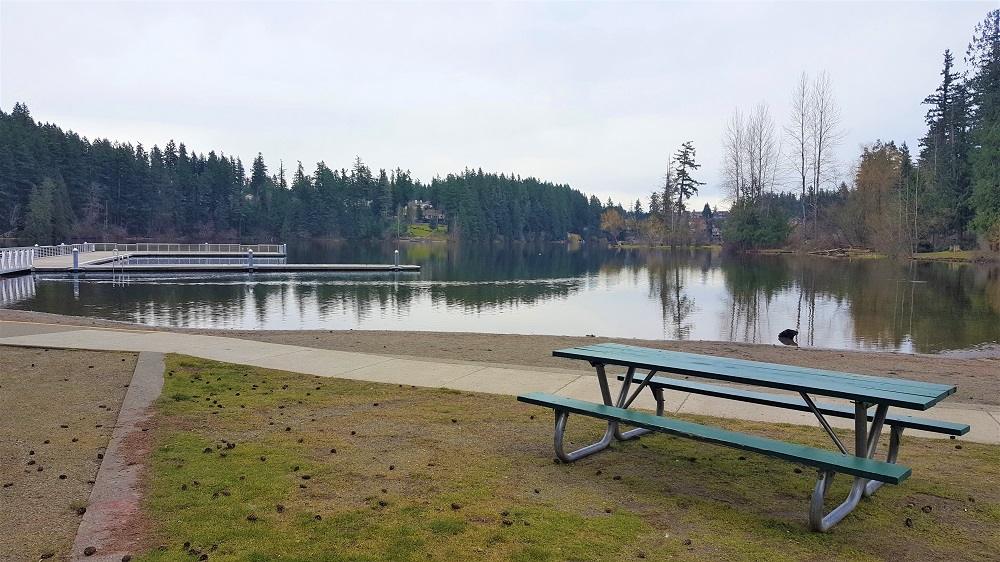
This jewel of a park in Maple Valley offers generous parking, playground equipment, paved paths, bathrooms, benches, picnic tables and even lake swimming in the summer. Enter the park on the right side of the parking lot opposite the lake. The paved trail curves around, passing a baseball diamond and the playground. Continue to the left, cross a small bridge and follow around toward the lake, ending at the dock. The lake is a beautiful place to pause and catch your breath. There are ducks, geese and often eagles.
In summer there is a roped-off swimming area with a lifeguard (check online for swim times). Head back toward the playground and there is a paved loop that goes right around the playset area. You could even push a younger child on the swings while the older one goes around and around.
Location: Lake Wilderness Park is located at 22500 S.E. 248th St., Maple Valley.
Trail details: There are about 3.5 miles of trails to explore here, including a 0.5-mile outer loop.
Nearby: Fuel — or reward — your ride with a treat from popular Crown Donut, just a couple of miles away.
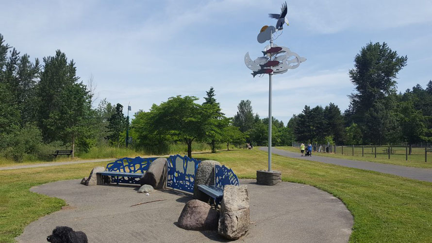
Chehalis Western Trail, Olympia
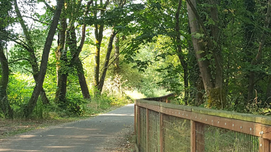
The path of the 21-mile-long Chehalis Western Trail used to serve as the historic Chehalis Western Railroad. Enjoy a variety of ecosystems and views as you ride, including Chambers Lake, Puget Sound, the Deschutes River and wetlands.
There are four trailheads, all with parking. A good place to get on this trail is at Chambers Lake Trailhead Park, where you’ll find parking and restrooms, though no play area. To find playground equipment, ride two miles south to reach Avonlea Park.
Location: Access the Chehalis Western Trail via Chambers Lake Park, located at 3725 14th Ave. S.E., Olympia.
Trail details: The 21-mile trail runs through the middle of Thurston County and eventually hooks up to the Yelm-Rainier-Tenino Trail.
Nearby: Fuel up on healthy fare at Olympia Food Co-op, a mile and a half the other way on the other side of I-5.
White River Trail, Auburn
This terrific paved trail runs through Roegner Park and Game Farm Wilderness Park. Start at either of these green spaces for a beautiful ride along the river. There are also plenty of benches for rest stops, picnic tables and grassy areas. Both trailheads offer restrooms, playsets and parking.
Location: Park and play at Roegner Park at 601 Oravetz Road S.E. in Auburn or Game Farm Wilderness Park at 2401 Stuck River Dr. S.E. in Auburn. You can access the trail at either park.
Trail details: The paved trail covers about 2 miles each way between the two parks.
Nearby: Game Farm Wilderness Park even has an 18-hole disc golf course, so bring along a disc! And even if it’s out of your way, you’ll want to make the 4-mile side trip to Legendary Doughnuts.
Foothills Trail, McMillin to Orting
The Foothills Trail occupies an old railroad bed and connects the cities of Puyallup and Buckley, snaking through other towns along the way. We especially like the McMillin-to-Orting section, which is a couple of miles long, ideal for bicyclists of all ages, strollers, scooters and anything on wheels! Start off at Orting’s central town park at Calistoga Avenue West and Washington Avenue South. Here you’ll find restrooms, Orting’s signature bell tower and room to run.
Head north to reach the McMillin Trailhead, 2.3 miles away, and turn around there or at any mid-point you like.
Editor’s note: A stretch of the Foothills Trail in Orting — from Lane Boulevard Northwest to Old Pioneer Way Northwest — is closed due to construction until summer 2026. There’s a temporary detour along Old Pioneer Way.
Location: Hop on the McMillin-to-Orting section of the trail at Calistoga Avenue West and Washington Avenue South in Orting.
Trail details: The asphalt Foothills Trail is 22 miles long, from Puyallup to Buckley, but can be enjoyed in smaller segments. The McMillin-to-Orting section is 2.3 miles long.
Nearby: Get your lunch at one of Orting’s many eateries near the park, or if you’re lucky enough to show up on a Friday in summer, check out the Orting Valley Farmers Market.
Nathan Chapman Memorial Trail, Puyallup
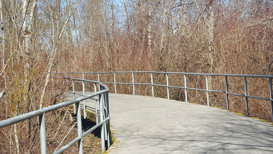
The Nathan Chapman Memorial Trail, named for a local Green Beret killed in Afghanistan in 2002, connects Puyallup’s South Hill Community Park and Heritage Recreation Center. The scenic trail cuts through wetlands and forests, offering plenty of shade on a sunny day.
Location: Access the Nathan Chapman Memorial Trail via South Hill Community Park at 14201 86th Ave. E. in Puyallup.
Trail details: The wide asphalt path is about 1.5 miles long. If that isn’t enough, add on the South Hill Park Loop Trail, a 1-mile loop that encircles the playground at South Hill Community Park.
Nearby: When you’re done, stop for a snack at one of the picnic tables and enjoy the playset. Or you can fill up with milkshakes and burgers at Out & About Burgers, a mile and a half east.
More family fun on wheels:
Editor’s note: This article was originally published in 2018 and updated most recently on May 5, 2026, by ParentMap’s editorial team with a thorough fact-check.