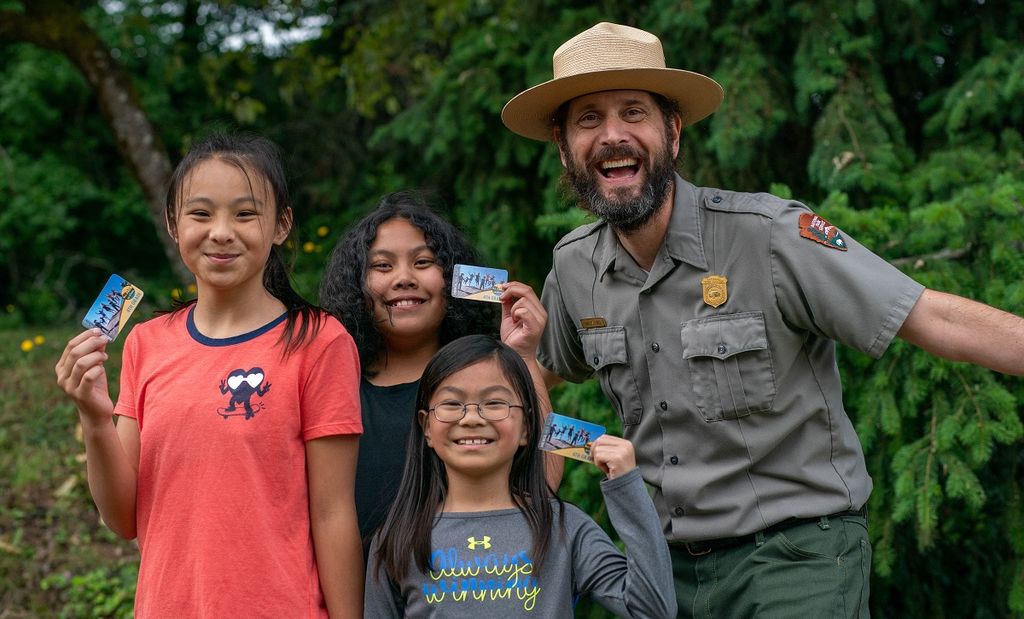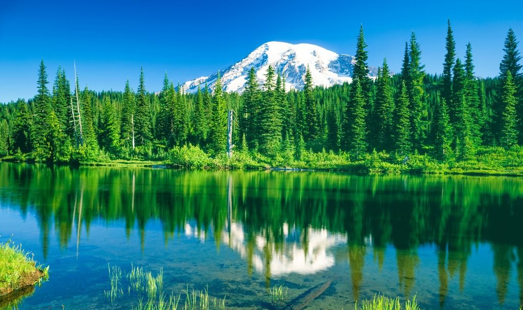

Drive up to any pass during a Pacific Northwest winter and you’ll see powderhounds making tracks. But here’s a secret: Not all of us are crazy about snow! Not to worry — while our peaks are blanketed in white, lower elevations host miles of hiking trails perfect for an alternative, snow-free winter wander.
Why hike in winter? Plenty of rain, for starters — our temperate rain forests come to life when the sun is tucked away. Some wild creatures are more active in winter, and others are simply easier to spot among leafless branches. Plus, many trails offer solitude during the off-season.
Be sure to check trail conditions with the local ranger station and consult the recent hiker trip reports at Washington Trails Association. Remember that it gets dark early, so turn around with plenty of time to make it back to your car in daylight. Dress the whole family in warm, water-wicking layers under rain gear, plus hats, gloves and scarves. Expect rocks to be slippery and trails to be muddy; waterproof boots are a must.
Now, hurry off to hike these kid-friendly trails, perfect for our wet winters!
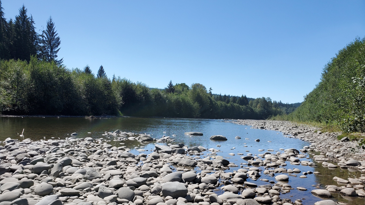
River hike: Bogachiel River
Where: Find the Bogachiel River on the Olympic Peninsula about four hours’ drive from the Seattle area.
Stats: 8–12 miles round trip; 400-foot elevation gain; Northwest Forest Pass required to park
Contact: Olympic National Forest Pacific Ranger District, 360-374-6522
Kids will love … using a magnifying glass to examine the amazing epiphytes (plants that grow on other plants) that festoon nearly every branch and tree trunk. A native plant guidebook will come in handy.
Many would say the most spectacular Pacific Northwest winter hiking experience is the Hoh River Trail in Olympic National Park. We’d agree — with an asterisk. If you want the beauty of the Hoh Rain Forest without the crowds, try the Bogachiel, a rain forest valley just to the north.
The hiking is flat and easy as it meanders through this mist-shrouded forest. You’ll start amid second-growth trees and then, when you cross into Olympic National Park after 1.5 miles, old-growth trees. Two stream crossings will get your feet wet (if you’re not wearing waterproof boots). Once you’ve had your fill of lichens and fungi, just turn around and return the way you came.
Getting there: Of the four rain forest valleys, the Bogachiel River Valley is the closest to the town of Forks. From town, head south on U.S. Highway 101 for 5 miles, then turn left (east) on Undi Road directly across from Bogachiel State Park. After 2 miles, turn left onto the Undi Road bypass, a primitive gravel road, and proceed 2 miles farther. Turn left at the stop sign onto Forest Service Road 2932 and continue to the trailhead for Bogachiel Rain Forest River Trail No. 825.
More hikes like this: The Old Sauk River Trail, just south of Darrington, is a flat, easy trail that meanders alongside the beautiful Sauk River. The first portion of the trail is gravel and can be hiked with a stroller.
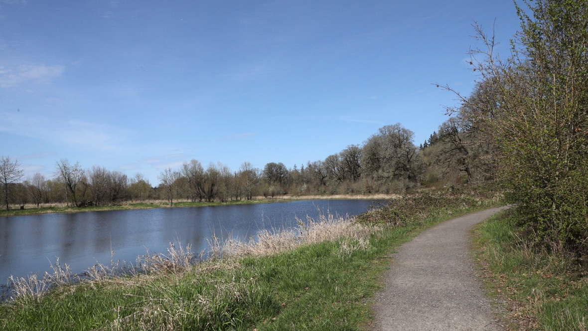
Wildlife hike: Ridgefield National Wildlife Refuge
Where: Find the Ridgefield National Wildlife Refuge south of Longview, about three hours’ drive from the Seattle area
Stats: 2 miles round trip; 100-foot elevation gain; entrance fee $3 per vehicle or up to four adults on foot, cash or check only (youth 15 and younger are free)
Contact: Ridgefield National Wildlife Refuge headquarters, 360-887-4106
Kids will love … searching for rare bird species, so bring binoculars! The rounded, azure heads of scrub jays are distinct from the pointy crests of our backyard jays, and smaller red-shouldered hawks flap over their winter wetland hunting grounds. Leave time to discern the elegant tundras from the trumpeters in famously large flocks of swans.
The Carty Unit’s Oaks to Wetlands Trail comprises 2 miles of trail through majestic, centuries-old Oregon white oak trees, fir and cedar woodlands, cottonwood and willow stands, and wetlands teeming with wildlife. Start by crossing the footbridge that spans the railroad tracks. Then, stroll along the looping interpretive paths as you search for birds.
Don’t miss: Keep the binoculars handy as you drive the 4.2-mile loop through the refuge’s other star winter attraction: the River S Unit. Keep your eyes peeled for black-crowned night herons roosting in trees, great egrets stalking prey in the marshes and several species of dabbling ducks in the water. To protect the birds, don’t exit your vehicle when stopping to view the wildlife.
Getting there: Ridgefield is about 2.5–3 hours south of Seattle in Clark County, along the Columbia River. To reach the refuge, take Interstate 5 south to Exit 14, heading west on Pioneer Street through the town of Ridgefield. Turn right onto North Main Avenue and drive 1 mile to the refuge’s Carty Unit entrance on your left.
More hikes like this: Spencer Island Park in Everett is an expansive, 400-acre estuary where the Snohomish River splits and braids into Puget Sound, creating a rich habitat that draws flocks of migratory waterfowl, shorebirds and raptors in winter months. Explore via a series of dike and boardwalk trails. South of Tacoma off Interstate 5, the Billy Frank Jr. Nisqually National Wildlife Refuge loop hike and series of boardwalk trails offer close-up peeps of wintering ducks, herons and even a family of nesting great horned owls.
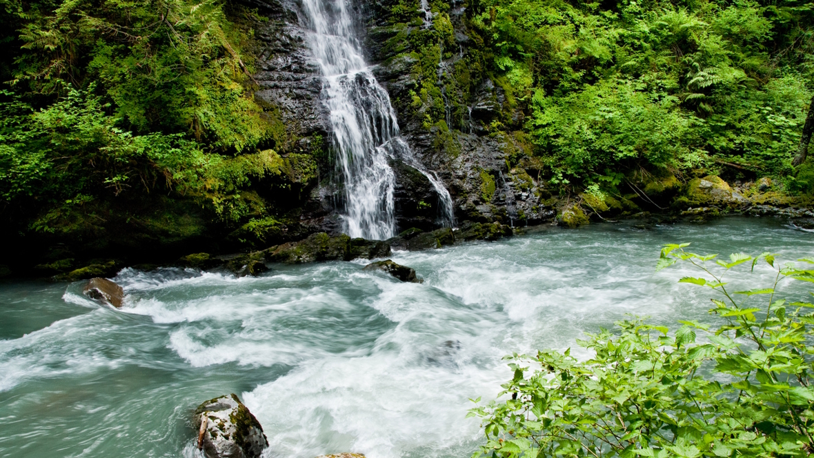
Waterfall hike: Boulder River
Where: Find the Boulder River east of the city of Arlington, about a 90-minute drive from the Seattle area.
Stats: Up to 8.5 miles round trip; 700-foot elevation gain; no pass required to park
Contact: Mount Baker Snoqualmie National Forest, Darrington Ranger District, 360-436-1155
Kids will love … gazing at the massive trees! The Boulder River Wilderness contains one of the last remaining lowland old-growth forest river valleys in the Cascades, with huge specimens of western red cedar, Douglas fir and western hemlock.
This low-elevation, low-effort hike takes you into a phenomenal old-growth wilderness, and because the trailhead is primitive (i.e., there’s no bathroom), it’s also free to access.
Follow the trail as it meanders through a carpet of ferns and mosses, all nicely shaded by a thick canopy. From the start, you’ll hear flowing water as the trail tracks marvelously close to its namesake, the beautiful Boulder River. The forest receives about 150 inches of rain per year, though well-built puncheon, turnpike and water bars help keep standing water off the trail, and log bridges help you safely cross the many small streams.
Several waterfalls plunge into the river from the steep cliff opposite the trail. The first is Boulder Falls. The trail’s highlight is a mile and a quarter in: Feature Show Falls, a colossal twin-curtain waterfall that streams down the mossy cliff wall. There’s a nice bench here where you can sit and take it all in. Just beyond, a rocky side trail leads down to the river for a perfect lunch spot. For a short hike, turn around here. Otherwise, continue through the verdant wonderland all the way to the trail’s end, then return the way you came.
Getting there: From Interstate 5, take Exit 208 onto State Route 530 to Arlington. Continue east for 20 more miles. At milepost 41, turn right onto Forest Service Road 2010 (French Creek Road) and drive 3.7 miles to the trailhead.
More hikes like this: If your kids don’t mind a little elevation gain to reach one of the most stunning waterfalls in the state, the trail to Wallace Falls (off U.S. Highway 2 near Gold Bar) should be on your list, as it leads to a multi-tiered cascade that plunges and tumbles its way over a cliff, sending mist in every direction. On the Olympic Peninsula near Lake Crescent, Marymere Falls is a short jaunt up steps and bridges fashioned from old-growth logs to the 90-foot cascade, which dramatically drops from a notch in a high cliff.
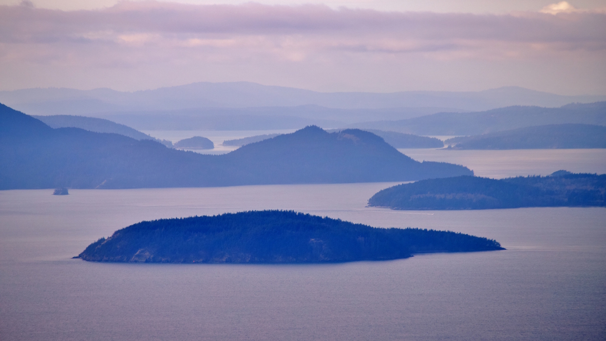
Peak-bagger hike: Oyster Dome
Where: Find Oyster Dome north of the town of Burlington, about a 90-minute drive north of the Seattle area.
Stats: 6.5 miles round trip; 1,900-foot elevation gain; Discover Pass required to park
Kids will love … spotting the islands, peaks, inlets and peninsulas visible from the summit on a clear day. Bring a map to confirm their guesses.
Ascend a mountain in air that smells like the ocean; Mount Blanchard is the only Cascade peak that rises directly from the Salish Sea. Most of the mountain (atop which Oyster Dome sits) has been protected for nearly a century, but you’ll still spot huge stumps and snags of the ancient forest that once was. The top of Oyster Dome is small, so arrive early in the day if you want to avoid crowds.
Getting there: From Interstate 5, take Exit 240 and head west on Lake Samish Road. Then, take the first left and travel 0.6 mile down Barrel Springs Road. You’ll see a sign reading Blanchard Forest Block. Turn right (onto a dirt road) and travel 1.7 miles until you see the sign for the Samish Overlook. Take a left and pass through a yellow gate. Drive 2.2 miles to the Samish Overlook Day Use Area.
More hikes like this: If your kids just want to bag a peak and don’t mind sharing the trail with dozens of other hikers, climb the well-maintained switchbacks that gain 1,160 feet in elevation to the top of Rattlesnake Ledge near North Bend. While you can drive to the top of Moran State Park’s Mount Constitution on Orcas Island, it’s more satisfying to reach the summit of the highest point on the San Juan Islands on foot.
Island hike: Fort Flagler
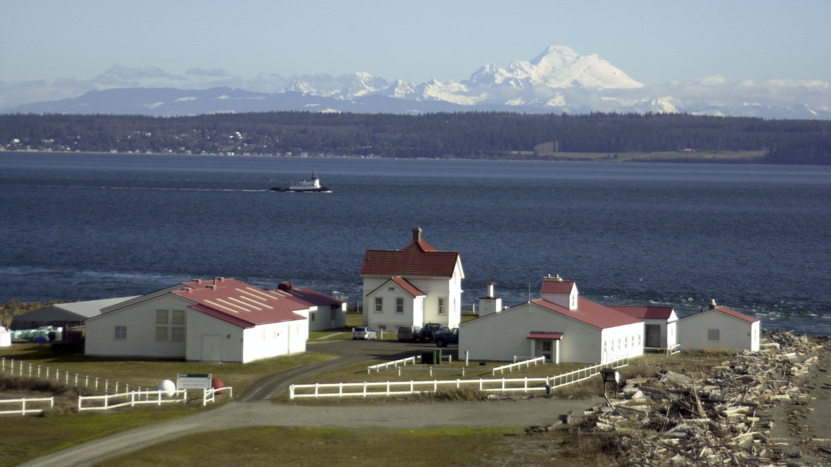
Where: Find historic Fort Flagler on the Olympic Peninsula near Port Townsend, about 2.5–3 hours’ drive from the Seattle area, not including ferry wait time.
Stats: 5 miles round trip; 150-foot elevation gain; Discover Pass required to park
Contact: Fort Flagler Historical State Park, 360-385-1259
Kids will love … a hike that weaves through living history. One of Puget Sound’s finest state parks was once one of five military installations built locally in case of an enemy attack. The invasion never came, but this U.S. Army coast artillery fort still stands, with interpretive signs to tell the tale.
Set on the northern tip of Marrowstone Island, Fort Flagler is often confused with its more popular cousin, Fort Worden State Park, which sits just a few miles to the west in the Victorian town of Port Townsend. But with more than 7 miles of hiking trails and 3.5 miles of beautiful beaches, Flagler is double the size and has twice the coastline.
This loop trail sets off from the park’s lower campground on a wide, stone-strewn beach heading east along a bluff with stunning vistas. You’re in the “rain shadow” here and may dodge drizzle, but you won’t be so lucky when it comes to the wind; dress warmly.
At 2.25 miles, leave the shoreline behind as the trail climbs a bluff, twists around a lagoon and eventually leads you back to your car. Along the way, you’ll pass a handful of historic buildings and bunkers. Bring binoculars to spot majestic bald eagles and dabbling ducks.
Getting there: From Seattle, catch a ferry across Puget Sound and cross the Hood Canal Bridge on State Route 104. Take a right onto State Route 19 (Beaver Valley Road) and head north for about 10 miles. Turn right onto State Route 116 (Irondale Road), driving east. The road crosses over Indian Island to Marrowstone Island. Continue north on SR 116 all the way up Marrowstone to Fort Flagler State Park.
More hikes like this: A hike at Ebey’s Landing, on the western edge of Whidbey Island, has it all: pounding surf, wild beach, a grassy bluff and dramatic views of the Olympics. On Orcas Island, take a short hike along a wooded bluff dotted with madrona trees down to 150 yards of uncrowded pebble beach at Obstruction Pass.
Editor’s note: Winter hikes can be a beautiful way to get outside, but conditions can change quickly this time of year. With recent flooding in our area, be sure to check weather forecasts, trail reports and local advisories before heading out. Stick to well-maintained routes, avoid flooded or unstable areas and always err on the side of caution, especially when hiking with kids.
More outdoor winter fun:
Editor’s note: This article was originally published in 2019 and was most recently updated on Dec.12, 2025, by ParentMap’s editorial team with new details and a thorough fact-check.