
Hike to a lake!
One great way to revel in our warm PNW summer days is to gather your crew and take a wander to a mountain lake. Exploring glacier-fed waters and picking late-summer berries are great ways to break up the routine. Pile the kids into the car, grab swimsuits and hiking boots, and head for the mountains, where nature’s pools await.
Mountain lakes are fed by glaciers and snowmelt, so be aware that the water can be quite chilly, even during summer. Lake bottoms may be sandy or rocky, jagged or smooth, so pack Crocs or water sandals to protect small feet. There is no lifeguard on duty in the wilderness, obviously, so keep a close eye on children and understand that you’re swimming at your own risk. Never allow children to venture under a waterfall, as small rocks can tumble over in the cascade and cause injury. Read on to find a lake hike near Seattle that suits your crew.
First up: Mirror Lake
Image credit: Nordique/Flickr CC
1. Mirror Lake, Snoqualmie Pass
Distance: 2.2 miles round trip, 870-foot gain in elevation; Northwest Forest Pass required to park
Info: Okanogan-Wenatchee National Forest, Washington Trails Association’s (WTA) trip reports, or call 509-852-1100
Kids will love: the scenic, refreshing swimming hole
Description: The “trail” begins from a lower parking area, though you can skip the first half-mile on a rough dirt road if you have an all-terrain vehicle and start from the upper parking area. From here, the real trail begins. Don’t be put off by the clear-cutting at the trail’s start, as you’ll be in an enchanting old-growth forest soon enough. At about half a mile in, you’ll find a spur trail to Cottonwood Lake, a sweet, shallow pond you can wade in (but it’s not worth skipping the star attraction for). Continue on as the trail climbs another half a mile to Mirror Lake, where placid emerald water reflects the ancient fir and hemlock trees that encircle it. Find a clear bank, put on your swimsuits and start soaking up the sunshine.
Directions: Take I-90 east over Snoqualmie Pass to exit 62. Head south on FR 54 for 1.5 miles, take a right on FR 5480, then go past Lost Lake to the trailhead.
Next up: Ashland Lakes
2. Ashland Lakes, Mountain Loop Highway
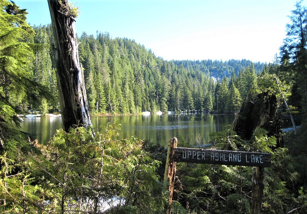
Distance: 5.5 miles round trip, 800 feet in elevation gain; Discover Pass required to park
Info: Washington Department of Natural Resources, WTA’s trip reports, or call 360-854-2882
Kids will love: the opportunity to inspect beaver activity, dragonflies and tadpoles up close
Description: This is a true Cascadian rain forest, one of the wettest spots on the mountain range’s western slope, and it’s got loads of spongy moss, slimy slugs and stinky skunk cabbage to prove it. On rainy days, the trail also has some very slippery boardwalk, so step with caution.
The trail skirts around three placid lakes fringed with sphagnum and peat bogs: first, a wetland home to dozens of dragonflies called Beaver Plant Lake; then Upper Ashland Lake; and finally to the largest, prettiest and most remote of all, Lower Ashland Lake. Most of the trail is on boardwalk, which gives kids the unique opportunity to get up close and personal with a variety of unique features of Northwest wetlands, including beaver dams, lily pads and frogs.
Directions: From Granite Falls, head east out of town on the Mountain Loop Highway for 15.2 miles. Turn right on FR 4020 and drive 2.6 miles. Turn right on FR 4021 and proceed 2 miles to the trailhead. Although this area is surrounded by Forest Service land, this trail and the lakes are state land (Washington Department of Natural Resources), so parking at the trailhead requires a Discover Pass.
Next up: Dorothy Lake
Image credit: Brian Teutsch/Flickr CC
3. Dorothy Lake, Highway 2
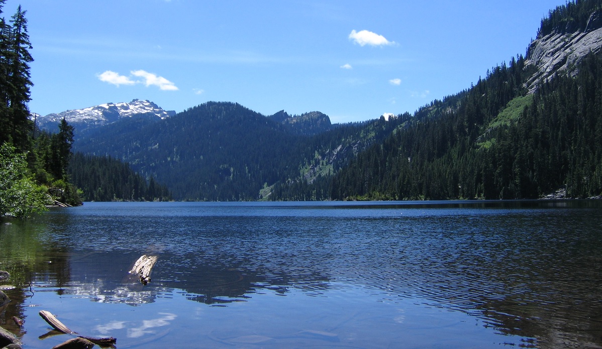
Editor’s note: The Miller River Road is washed out four miles from the trailhead. Be sure to check the website for updated information regarding when this hike will be accessible again.
Distance: 3.5 miles round trip, 800 feet gained in elevation; Northwest Forest Pass required to park
Info: Mount Baker Snoqualmie National Forest, WTA’s trip reports, or call 425-888-1421
Kids will love: the many trail structures on this hike, from steps to bridges
Description: The perfect lake hike has two requirements: irresistible water for swimming and an access trail just difficult enough to work up a sweat along the way. This sparkling mountain gem in the Alpine Lakes Wilderness offers both. What it doesn’t deliver is solitude. Though at 2 miles long, the lake’s shoreline offers plenty of room for everyone.
All of those boots have persuaded the Forest Service to keep the trail in tip-top shape, with well-built stair-steps and a boardwalk. After about a mile, the trail enters wilderness and crosses Camp Robber Creek. From the sturdy bridge here you’ll spy the creek plunging into a refreshing swimming hole, which makes a great pit stop on sweltering days. Hike on another half of a mile or so to sprawling Lake Dorothy. A spur trail to the lake’s outlet takes you to a giant log jam that offers the best photo op of the lake as well as access for wading in. The main trail continues on a high path along the lake’s eastern shore, which is interspersed with short side trails down to established campsites, picnic spots and access points for taking a dip.
Directions: Take U.S. Highway 2 east past the town of Gold Bar. Just before milepost 46, look for the turnoff to Money Creek Campground and make a right onto Old Cascade Highway. Drive 1.1 miles, then turn right onto Miller River Road (FR 6412). From here, it is 9.5 miles to the road’s end and trailhead on gravel, though the road isn’t rough and the time passes quickly from the backseat when peering into the woods for a glimpse of Sasquatch.
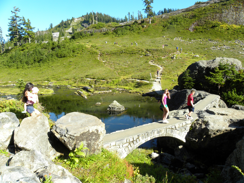
Next up: Bagley Lakes Loop
Image credit: Amenokami/Flickr CC
4. Bagley Lakes Loop, Mount Baker
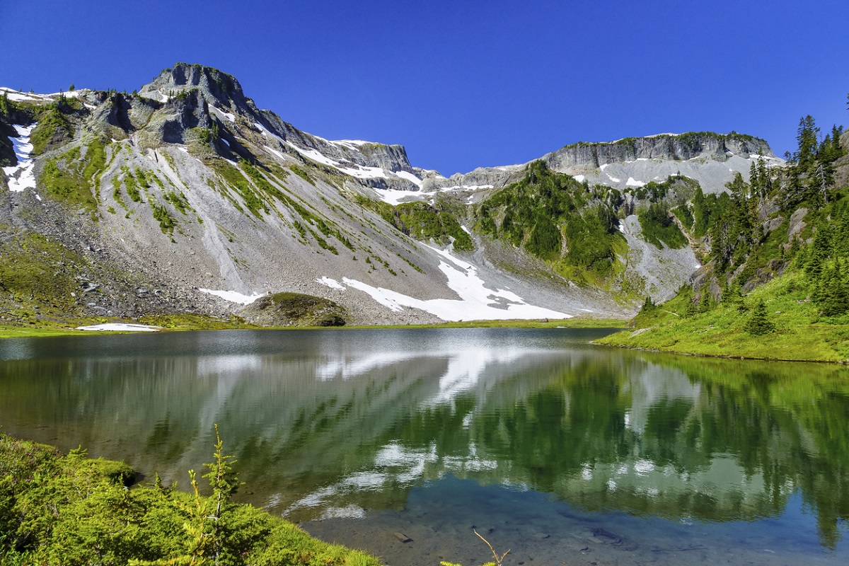
Distance: 2 miles round trip, 150 feet in elevation gain; Northwest Forest Pass required to park
Info: Mount Baker-Snoqualmie National Forest, WTA’s trip reports, or call 360-599-2714
Kids will love: hiking on an active volcano, with lava inside and ice on top
Description: Hike around beautiful glacial tarns ringed with granite outcrops and huckleberry bushes. The trail begins by dipping down towards Lower Bagley Lake. You’ll hike a short distance before coming to a junction — keep to the left to proceed on the loop clockwise. This path takes you on the east shore of Lower Bagley Lake along a flat trail of crushed rock. At the lake’s upper end, follow alongside the alpine stream that flows from Upper Bagley Lake and enjoy the increasingly open views of a looming peak with a very flat top: Meet the aptly named Table Mountain. Just under a mile in is a twin-arch stone bridge that spans the outlet stream from Upper Bagley Lake. Cross the unusual bridge (pausing for a photo op) and instead of heading back to the trailhead from here just yet, take some time to meander along the upper lake’s north shore until you find a great spot to rest and maybe dip your feet in.
This trail is short but absolutely stunning and leaves the kids plenty of time to load up on juicy huckleberries you may encounter along the way. For older kids, a longer loop option extends the hike from Bagley Lakes up to include the half dozen or so Chain Lakes (8 miles round trip, 1,600 feet gained in elevation), making this beautiful hike twice as long and three times as difficult, but adding more stunning scenery and sparkling tarns.
Directions: From Bellingham, head east on the Mount Baker Highway (SR 542) all the way to the Heather Meadows parking lot, signed for Bagley Lakes. Heather Meadows is just after the Picture Lake Trail and just before the ski area.
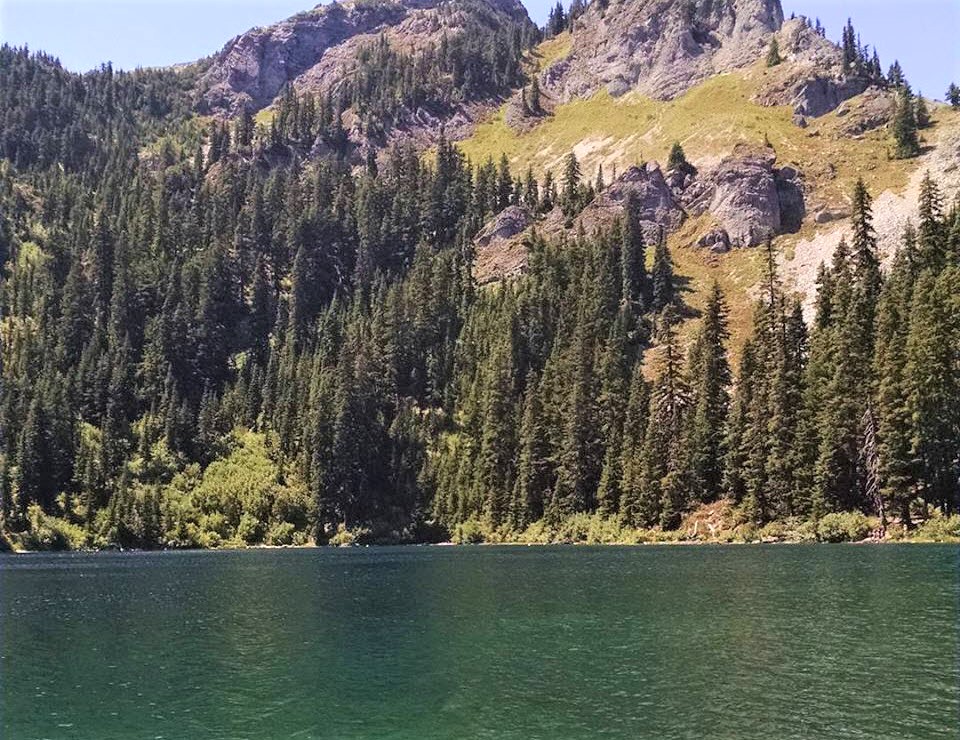
Next up: Hyas Lake
5. Hyas Lake, Teanaway
Distance: 4 miles round trip, 100 feet in elevation gain; Northwest Forest Pass required to park
Info: Okanogan-Wenatchee National Forest, WTA’s trip reports, or call 509-852-1100
Kids will love: the shallow, sandy lake floor that makes for great wading on hot days
Description: Washington’s famed Alpine Lakes Wilderness east of Seattle boasts a whopping 700 lakes within its glacier-carved terrain, from tiny emerald tarns rumored to be frequented by leprechauns (kids, keep your eyes peeled!) to huge turquoise pools flanked by granite boulders. Hyas Lake is one of the easiest of those lakes to reach, and a smattering of established campsites around the lakeshore make it one of the most popular first-time backpacking trips for Puget Sound families.
The trail starts flat and forested from the Deception Pass trailhead in the Upper Cle Elum River Valley. Half a mile in, you’ll cross a small stream and the wilderness boundary. Keep kids motivated to move on from the patches of ripe black huckleberries along the trail in August or you’ll never make it to the lake to wash off those purple-stained fingers. Under 2 miles in is your destination: a long, shallow lake ringed with reeds and forest that reflects the looming peaks of Cathedral Rock and Mount Daniel. The trail continues all the way to the upper reaches of the lake, about 1 mile more. Follow it to reach the best picnic and lake access spots, which get better as you hike on.
Directions: Take I-90 east over Snoqualmie Pass to Cle Elum/Roslyn, exit 80. Proceed on Highway 903 north for about 7.6 miles, where it becomes the Salmon La Sac Road; you’ll continue for another 10.4 miles. Near the Salmon La Sac Campground, veer northeast onto FR 4330 (also called the Cle Elum Valley Road) and from there you’ll drive about 11 miles of unpaved road to the trailhead.
More great hikes for Puget Sound–area families:
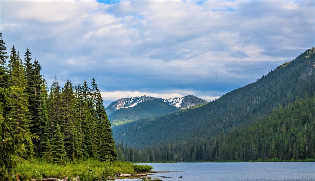
Editor’s notes: Image credit Graham Clenaghan/Flickr CC. This article was originally published several years ago and updated most recently for 2023.