
Exploring the Issaquah Alps
If getting outside more with the kids remains on your bucket list this fall, we’ve rounded up five kid-friendly hikes in the Issaquah “Alps” for beginners through teens! Two of the fun trails are perfect starter hikes — offering a story to read along the way in the form of storyboards. For a bit more of a trek, the Talus Rocks Trail on Tiger Mountain will impress even your teens when they see the giant glacial erratics at the top! (Glacial erratics are humongous boulders.)
You’ll see that several of the hikes are add-ons to other hikes, so you can choose a distance that suits your crew and their enthusiasm for exploring in the woods on any given day.
Okay, it’s time to get out there and investigate our local Issaquah “Alps!”
First up: Pretzel Tree Trail
Pretzel Tree Trail
Find it: 201430 S.E. May Valley Rd., Issaquah, WA 98027
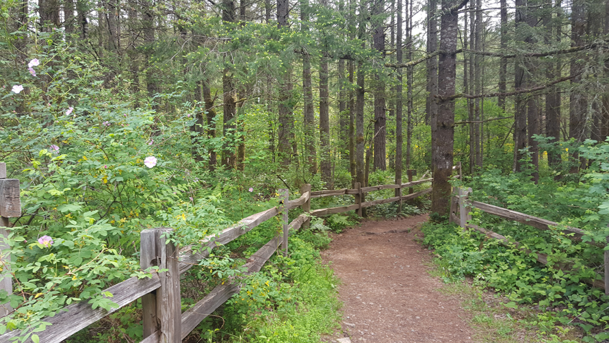
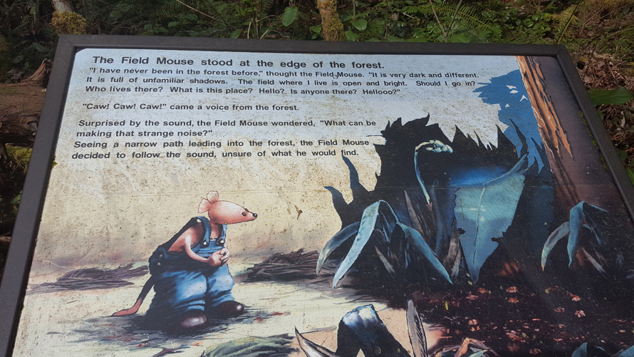
The short, sweet Pretzel Tree Trail is a fun 0.3-mile loop in Squak Mountain State Park. It’s perfect for introducing tots to nature, stretching your legs or getting warmed up for a longer hike. The trail features storyboards detailing the adventures of Field Mouse as he searches for the Pretzel Tree. Along the way, he meets other forest creatures and learns about how they fit into the local ecosystem.
Squak Mountain State Park has a good parking lot: Note you’ll need a Discover Pass to park there. There are pay stations near the pit-toilet restrooms in case you don’t have a pass already. Leashed dogs are welcome on this trail.
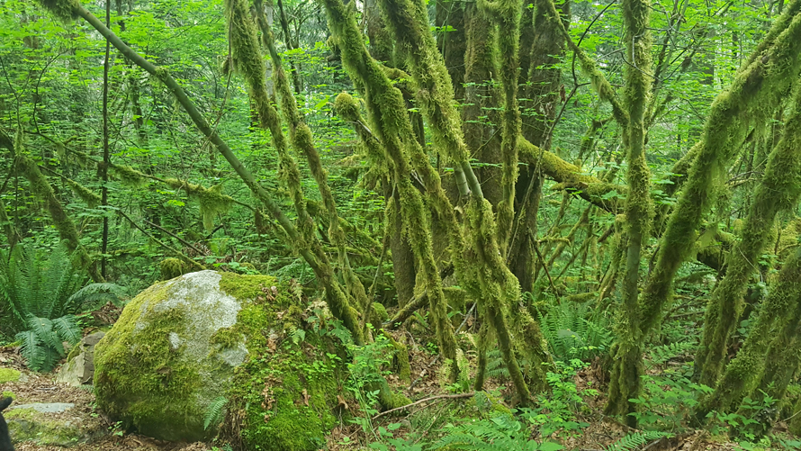
Enter the trail at the rear of the parking lot (opposite the restrooms). Walk along until you see a road. Cross the street and find the sign for the Pretzel Tree Trail. Take the trail straight ahead to read the story in the correct order. This path is mostly flat and really pretty. Along with the storyboards you will see hanging moss, nurse logs, ferns and maybe even a few wildflowers. You can also hear the babbling creek that is nearby and lots of birdsong. The tree canopy kept the temperature cool even on the sunny day we went.
The story was fun to read and kept even older kids going as they moved ahead to read the next part of the tale. Near the end, look for the trail’s namesake, Pretzel Tree. It is two tree trunks that grew together, twisting around each other like a pretzel. I didn’t actually find the tree so impressive, but it’s worth checking out. The loop ends right back where you started and the kids may want to walk it again, as there is a lot to see.
Quick add-on hike to a bridge
For a short add-on to the Pretzel Tree Trail, find a sign a few feet down from where you exited the loop that says “May Valley Loop, Central Peak and Mountainside Drive.” Take this trail up the hill until you reach a wooden bridge, about a third of a mile in. The bridge spans a stream that cascades over some rocks, making a little waterfall. After you check out the waterfall, just turn around and head back down. If you do both little hikes, the total distance is about 1.2 miles. There are picnic tables in the parking lot area to rest up and have a snack.
Next up: Swamp Monster Trail
Swamp Monster Trail
Find it: Begin this hike at Tiger Mountain’s High Point Way trailhead; to reach it, take exit 20 off I-90, turn south onto 270th Avenue S.E., then turn right onto S.E. 79th Street. A Discover Pass is required to park in the lot (see parking notes below).
The Swamp Monster Trail is a great, flat storybook trail with signs relaying a story called “Zoe and the Swamp Monster.” The tale details a girl’s encounters with trail monsters, but don’t worry, you won’t see any monsters or swamps on this tot-friendly hike!
Near the parking lot at the High Point Way trailhead, there is a detailed map on a kiosk. It’s not a bad idea to take a picture of the map with your phone if you don’t have a paper map with you. From the kiosk, follow the trail straight ahead to a clearing that has a restroom and several trail signs. Follow the “Swamp Trail” sign pointing right. To get to the Swamp Trail, cross a road and come to a wooden horse barrier fence (low sections of wooden fence placed in a zig-zag pattern), and you will soon find the first part of the Zoe and the Swamp Monster story on a large red board. Read the first piece of the story here, then continue on as you read all seven boards. The path is mostly flat and easy to navigate with small children. The Swamp Monster Trail is about a half-mile each way. When you come to the next horse barrier, you are at the end. Turn around here and head back for a one-mile round trip, or continue on to the Big Tree Trail (see next page).
Parking notes: The road to the trailhead ends at a gate. This gate is closed at dusk, so if you plan on being out past that time, be sure to park outside of the gate. There is a small roadside lot and street parking which can be used if you don’t have a Discover Pass (or if the main lot is full). If you park there, take the small trail starting at the roadside parking up the hill for a half-mile to the trailhead. But if you have a Discover Pass and don’t plan to stay past dusk, drive through the gate and uphill to the bigger lot.
Next up: Big Tree Trail
Big Tree Trail at Tiger Mountain
Find it: This trail is an add-on to the Swamp Monster Trail, accessed from the High Point Way trailhead at Tiger Mountain.
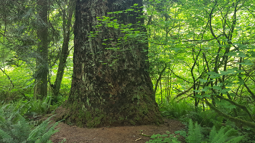
The Big Tree Trail is a connector trail and an easy add-on to Swamp Monster. The “Big Tree” is just that — a huge Douglas Fir that is thought to be one of the oldest and largest trees on Tiger Mountain. It is estimated to be many hundreds of years old.
To get to Big Tree Trail: At the end of the Swamp Monster Trail, continue through the wood barrier and cross through an open clearing and walk under some power lines. Re-enter the forest and then follow the path which has some gentle, rolling hills until you come to the Big Tree. The tree is fenced off and there is a bench to sit on and information about the tree on a plaque. Because you can’t get too close, it is a little hard to grasp its size, but its circumference measures 24 feet and the first branch is 75 feet off of the ground. Wow! Turn around and retrace your steps back to the Swamp Monster Trail and back to the main trailhead for a total distance trekked of about two miles. Still up for more exploring? Page ahead for additional trails in this same area.
Next up: Bus Trail, Round Lake and Tradition Lake
Bus Trail, Round Lake and Tradition Lake
Find it: This trail is an add-on to the Swamp Monster and Big Tree trails, accessed from the High Point Way trailhead at Tiger Mountain.
If your crew is up for a little more exploration, terrific add-on trails take you by a pretty lake and an abandoned bus. There is a quite a web of trails in this area. Be sure to pay close attention to your route.
From the Big Tree, continue on until you come to a “T”. Here you will see the Brink Trail sign on your right. Turn left on the Brink Trail. Pass under a power line and come to a spot where you can go three ways. Here you will see the Adventure Trail sign straight ahead of you. Facing the Adventure Trail sign, take the trail on your left that goes uphill. At the top of the hill you will see a trail on your right, which is not marked with a sign; it is the Wetlands Trail. You will know you are in the correct spot if you see a telephone pole with the numbers: 219531,170783 on the right a few feet in. Keep on this trail until you come to a sign for Wetlands Trail and Wetlands Connector. Stay right to take Wetlands Trail.
You will soon see glimpses of Round Lake through the foliage and eventually will come to a clearing with a bench to rest and observe Round Lake. This is a perfect spot to pause and take a water break.
When you are ready, continue on until you see the Bus Trail sign. Go left and walk a few hundred feet to see the rusted-out remains of an old bus. This bus has been there for ages and it is speculated that loggers possibly converted it into a field kitchen, but who knows? You can walk right up to the bus, but caution kids not to climb or play on it, as it has sharp, rusty edges.
When you are done checking out the bus, backtrack to the sign and head north. This will take you to the Around the Lake Trail; take a right turn there. On this path, you will get nice views of Tradition Lake; be sure to stop at the viewing deck. As you head back, look for the in-ground plaques that display varying animal footprints. You will exit at the Forest trail and cross the road and then walk straight back to the trailhead where you began.
Next up: Talus Rocks
Talus Rocks at Tiger Mountain
Find it: Begin this hike at Tiger Mountain’s High Point Way trailhead; reach it by taking exit 20 off I-90, turn south onto 270th Ave. S.E., then turn right onto S.E. 79th St. A Discover Pass is required to park in the lot (see parking notes below).
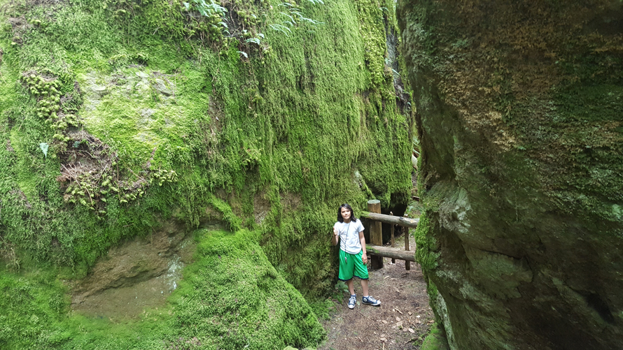
The Talus Rocks hike is a fair bit more challenging than previous hikes, because of the elevation gain, but seeing the huge rocks at the top is totally worth it. The Talus Rocks are a collection of boulders — called glacial erratics — that drifted to Tiger Mountain during previous ice ages. Now these giants are home to lots of plant life and there are even small cave-like gaps that are formed where the rocks are close together.
Near the parking lot at the trailhead, there is a detailed map at a kiosk. It’s not a bad idea to take a picture of the map with your phone if you don’t have a paper map with you. From there, take the trail straight ahead to a clearing that has a restroom and several trail signs.
Begin this hike on the trail called West Tiger 3. It starts out easy on a wide, gravel path, but then starts going up, up, up. You will gain almost 600 feet over the first mile — it’s a leg burner! Keep going until you see the Talus Rock trail sign on your right. The sign is just a few feet in. The Talus Rock trail is much narrower and is dirt instead of gravel. We crossed a couple of wet areas in which there were logs to walk on and a wood bridge in one spot. There is a pretty place where the water cascades over a rock fall forming a little waterfall. When you see the waterfall, you are almost there!
Once you reach the rocks, prepare to be amazed. They are huge! (The picture with my nearly 5-foot-tall son standing in front of one gives you an idea.) There is a series of steps on the right which leads to a semi-flat area that’s good for taking a break or taking in the view. On the left, a trail goes up and around to the top level of the rocks. There are wood barriers in a few spots (one was broken) so be careful in that area.
This is really fun to explore but use caution as there are multiple steep drop-offs, especially on the top level. There are also caves in between where the rocks meet. I read that there have been bat colonies observed in the caves in the past. I wouldn’t recommend going inside the caves or going past any of the wood barriers, for safety’s sake.
Once you’ve had enough of the big rocks, simply turn around and go back the way you came for a 3.5-mile round-trip hike.
Parking notes: The road to the trailhead ends at a gate. This gate is closed at dusk, so if you plan on being out past that time, be sure to park outside of the gate. There is a small roadside lot and street parking which can be used if you don’t have a Discover Pass (or if the main lot is full). If you park there, take the small trail starting at the roadside parking up the hill for a half-mile to the trailhead. But if you have a Discover Pass and don’t plan to stay past dusk, drive through the gate and uphill to the bigger lot.
More hikes for Seattle-area families
Editor’s note: This article was originally published several years ago and updated most recently for 2023.