Photo:
Credit: W&J, Flickr CC
My family and I donned our day packs and slathered on sunscreen, ready to begin our 6-mile hike. But we weren’t at a mountain trailhead; we were at Seattle's Gas Works Park, ready for an urban hike around Lake Union. Instead of wildflowers or snowy peaks, we hoped to see bridges, boats, seaplanes, parks, neighborhoods and even a troll.
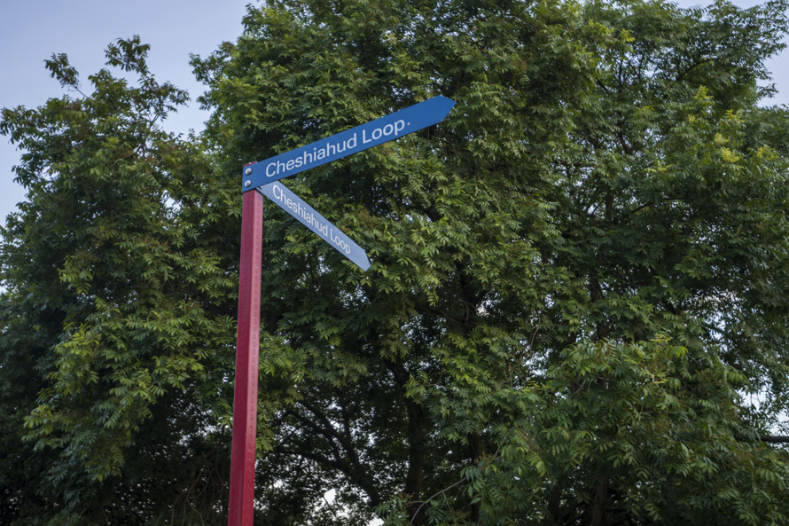
A connected series of paths, walkways and streets, the loop around Lake Union is called the Cheshiahud Lake Union Loop, named for John Cheshiahud (pronounced "Chesh-ee-AH-hood"), a leader of the Duwamish Tribe who once lived along Portage Bay. The route was dedicated in 2009 to connect parks, waterways and open spaces, and to provide access to the lake.
On a warm summer afternoon, my husband, 10-year-old son and I took in views of the lake, crossed multiple drawbridges and explored the Eastlake neighborhood, a mix of old and new Seattle. We also passed 35 pocket parks, a playground, the Museum of History and Industry, the Center for Wooden Boats and Lake Union Park. And with the addition of less than a mile, we explored the sights of Seattle’s Fremont neighborhood, the self-proclaimed Center of the Universe.
Starting point
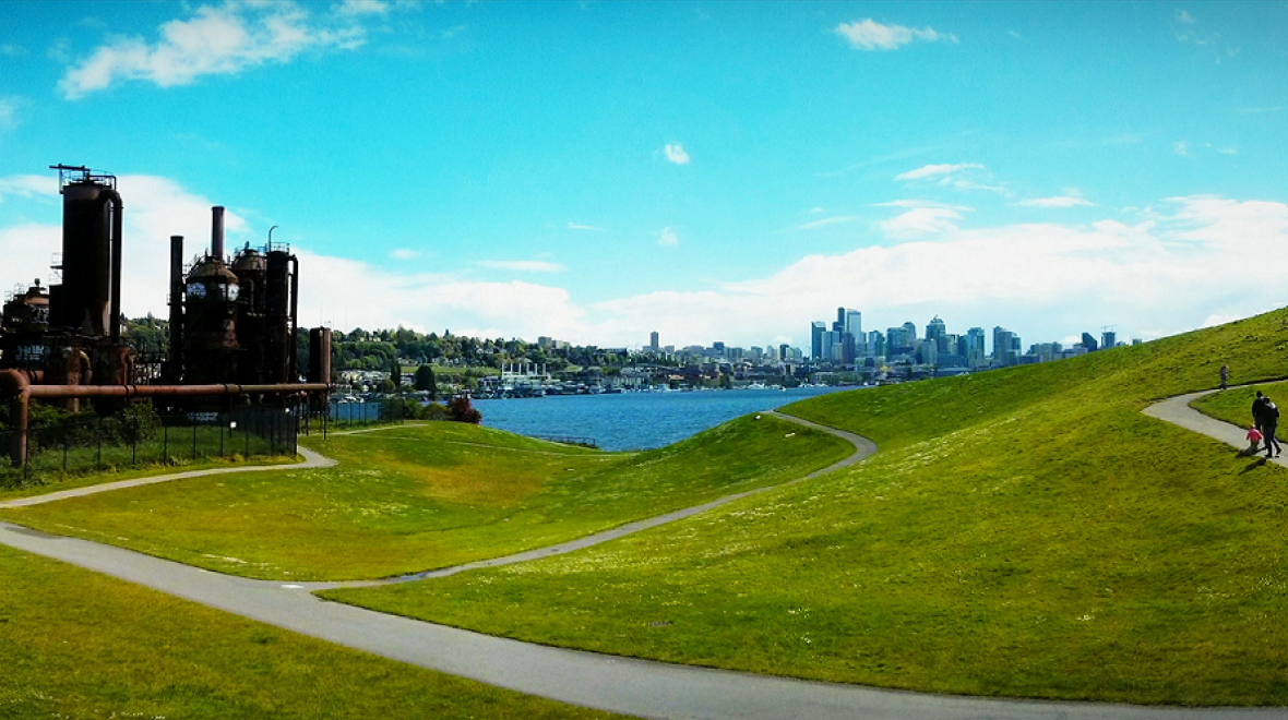
To begin our hike, we parked in the free lot at Gas Works Park at 2101 N. Northlake Way. This former coal gasification plant turned public park is a must-see in Seattle. The 19-acre park offers lots of grassy space, a fantastic new playground and panoramic views of Lake Union from Kite Hill. Kite Hill sports a large sundial and is perfect for catching a breeze and flying a kite. We had to pry our son away from the park after several runs up and down the hill.
After a restroom break (Gas Works has some of the few public restrooms along the route), we began our walk just in front of the Urban Surf Shop, heading east to go clockwise around the lake. In this section, the Cheshiahud Loop follows the popular Burke-Gilman Trail, so we watched for bikes and yielded to all wheeled traffic. The paved trail parallels Northeast Pacific Street, which is fairly busy, so watch young children closely. This part of the loop is a bit noisy due to traffic, but what it lacks in quiet it makes up for with amazing views of Lake Union.
Eastlake neighborhood
Next, we turned right and headed south across the University Bridge. While crossing we spotted sailboats, yachts, kayaks and paddleboards out on the water. After the bridge, the trail winds its way through the Eastlake neighborhood. This part of the loop isn’t a traditional trail, but a walk through a neighborhood on smaller city streets. At times we had to look for the signs to make sure we were still on the trail. A note on this section: There are a couple of short, steep stretches, but this was the only part of the loop that had much elevation gain.
Our favorite Eastlake spots included the P Patch community garden, two little free libraries and two parks: Lynn Street Mini Park at 2291 Fairview Ave. E., which offers access to the lake for getting your feet wet and pretty mosaic benches; and South Passage Point Park at 3320 Fuhrman Ave. E. The latter sits between the pillars of the towering (and noisy) I-5 ship canal bridge and offers lovely views plus a giant weeping willow. The branches hang almost to the ground all the way around the tree; our son loved running in and out of the curtain of leaves. We caught glimpses of houseboats on the lake from Fairview Ave. E. between the Blue Ribbon Culinary School and Terry Pettus Park.
Further along in the Eastlake area, we came across a fun kids’ play structure, a section of the loop along a boardwalk and several restaurants that would make for a good lunch stop. We watched seaplanes taking off and enjoyed the boats.
South end of Lake Union
After about four miles of walking, we reached Lake Union Park at 860 Terry Ave. N. at the south end of the lake. Here we could have passed several hours touring the Museum of History and Industry (MOHAI), the Center for Wooden Boats, Northwest Seaport, Steamship Virginia V and generally enjoying the park. Wanting to continue and fueled up on ice cream from a food truck, we decided to save those diversions for another day and kept going.
From Lake Union Park, we headed north where the trail parallels Westlake Ave. We didn’t see as many parks, but we stopped at a couple of street-end overlooks to take in the view of houseboats and some sizable yachts.
Fremont neighborhood
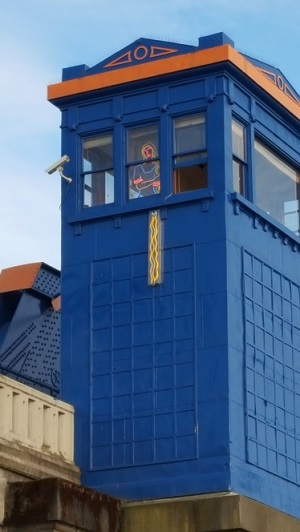
At the north end of Westlake we turned to cross the fun, funky Fremont Bridge. You may have to wait to cross because, reportedly, this bridge is the most frequently opened drawbridge in the country — due to its low clearance. We didn’t mind waiting because watching it open as a boat passed was part of the fun. Painted bright blue and orange, the bridge’s two control towers also boast neon light sculptures. An elephant and crocodile from Rudyard Kipling's fable frolic on one, while on the other Rapunzel poses in a window with her hair trailing down the side of the tower. Even if you’ve seen the bridge before while driving, crossing on foot offers a different perspective — and time to look carefully.
Once across the bridge, you can descend the steps to the right to continue the last mile along the Burke Gilman Trail back to Gas Works Park. Or, take a tour of Fremont (see below).
Even though we all had sore feet at the end of this hike, we loved exploring iconic Seattle sights as well as seeing the entire perimeter of beautiful Lake Union.
Tips for families...
- Reference the trail map to find the way. The entire loop, without the Fremont detour, is 6.2 miles.
- There isn’t much shade, so pack plenty of water and sunblock if it’s sunny. The walkway is almost entirely paved so if you bring your dog, consider that the surface may be hot for paws.
- This trail is shared between bikes and foot traffic — and while some areas are marked with bike and pedestrian lanes, not all are, so watch out for bike traffic. Especially if your kids are like mine, who like to wander all over the trail!
- The trail is free and open to all and accessible at any point. You may pay for parking depending on where you choose to park. We found the easiest place to park for free was at Gas Works (though do not leave valuables in your car here). There is street parking available, generally paid, in Fremont, Eastlake and along Westlake Ave. N.
- There are only two public restrooms on the map: at Gas Works Park and Lake Union Park.
- We took about four-and-a half hours to complete this hike. We could’ve done it more quickly, but part of the fun for us was stopping to see the sights. For younger kids who aren’t up for a 6-mile walk, consider bringing a buddy and two cars or do an out-and-back along one section.
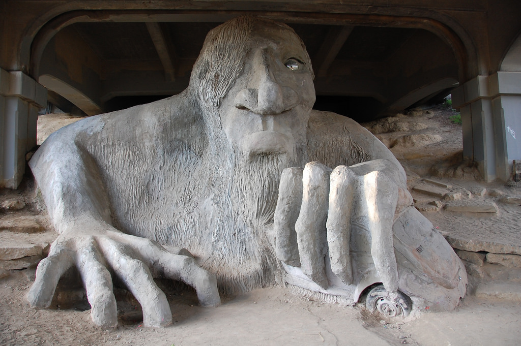
Fremont side tripAdding a side trip through Fremont will take you past several cool sights! The Interurban Statues (north end of the Fremont Bridge): We brought a Hawaiian shirt, lei and cape to dress up the figures. We carefully moved some decorations celebrating someone’s birthday and gave one of the statues the shirt and lei, and then wrapped the cape around the female statue. We took a few pics then removed our costumes and replaced the preexisting ones. Statue of Lenin (Fremont Place N. and N. 36th St.): The famous, or infamous, 16-foot bronze statue of Vladimir Lenin has sparked controversy, and the hand of Lenin was spray-painted red the day we visited. I read that activists regularly do this to demonstrate the blood on the hands of the communist leader. If you have older kids, this would make an excellent discussion point and history lesson, as well as conversation about art and the feelings art can provoke. The Fremont Rocket (Evanston Ave. N. and N. 35th St.). The Fremont Troll (Troll Ave. N. and N. 36th St.): We loved seeing the giant troll under the Aurora Bridge. This guy was definitely the highlight of the hike for our son! I was wowed by how huge the sculpture is and our son loved climbing around on it. From the troll, we walked downhill on Troll Ave. and turned left on N. 34th St. to rejoin the Burke Gilman Trail back to Gas Works Park. Our Fremont side trip added less than a mile to our walk. You could also create your own tour with this handy walking guide to Fremont. |
Editor's note: This article was originally published in 2017 and updated for 2019.
